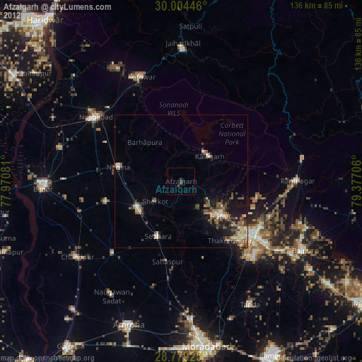
Afzalgarh night lights from space
Night Light of Afzalgarh (Uttar Pradesh) from space (India) Src. Average luminocity for 10x10km area is 7.2405% and for 50x50km: 11.9084%.
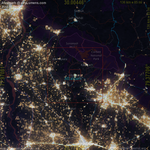
Analysis of Afzalgarh night lights 2016
Square area 10x10 km:
 0.38%
0.38%90-99
0.57%80-89
1.33%70-79
0%60-69
0.76%50-59
0.57%40-49
3.22%30-39
1.52%20-29
2.08%10-19
2.46%0-9
87.12%Square area 50x50 km:
0.63%90-99
1.72%80-89
0.96%70-79
0.92%60-69
1.23%50-59
1.95%40-49
3.3%30-39
2.75%20-29
4.67%10-19
11.59%0-9
70.28%Clear (daylight) street map image can be seen on geolist.org.
Map coordinates:
30° 0' 16.1" North, 77° 58' 14.9" East
29° 23' 37.3" North, 78° 40' 26.1" East
28° 46' 45.3" North, 79° 22' 37.4" East
Some cities around Afzalgarh sort by population:
• Nagīna
23.7 km =14.7 mi,  283°
283°
• Sherkot
12.2 km =7.6 mi,  232°
232°
• Dhāmpur
18.4 km =11.4 mi,  239°
239°
• Nihtaur
28.8 km =17.9 mi,  254°
254°
• Seohāra
22.1 km =13.7 mi,  202°
202°
• Jaspur
19.6 km =12.2 mi,  130°
130°
• Thakurdwara
28.9 km =18 mi,  140°
140°
• Kālāgarh Project Colony
14.2 km =8.8 mi,  48°
48°
1279307 (p: 27,753)
Sources (retrieved 2019-11-25):
» Earth at Night: Flat Maps 2012, 2016