Kanchipuram night lights from space
Night Light of Kanchipuram (Tamil Nadu) from space (India) Src. Average luminocity for 10x10km area is 69.5173% and for 50x50km: 20.3458%.
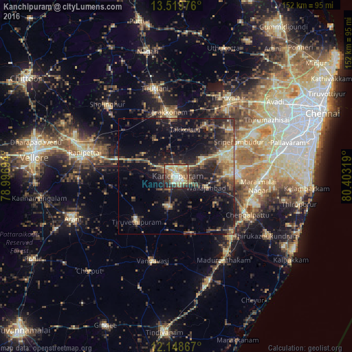
Analysis of Kanchipuram night lights 2016
Square area 10x10 km:
 4.11%
4.11%90-99
18.83%80-89
24.89%70-79
10.82%60-69
10.17%50-59
8.01%40-49
10.39%30-39
3.9%20-29
7.58%10-19
1.3%0-9
0%Square area 50x50 km:
0.34%90-99
2.05%80-89
3.73%70-79
2.37%60-69
2.23%50-59
3.74%40-49
5.17%30-39
4.99%20-29
8.08%10-19
15.62%0-9
51.7%Clear (daylight) street map image can be seen on geolist.org.
Map coordinates:
13° 31' 11.1" North, 78° 59' 49" East
12° 50' 6.5" North, 79° 42' 0.2" East
12° 8' 55.2" North, 80° 24' 11.5" East
Some cities around Kanchipuram sort by population:
• Arakkonam
27.9 km =17.3 mi,  353°
353°
• Chingleput
34 km =21.1 mi,  117°
117°
• Cheyyar
25.8 km =16 mi,  221°
221°
• Uttiramerūr
25.3 km =15.7 mi,  165°
165°
• Srīperumbūdūr
30.1 km =18.7 mi,  60°
60°
• Wallajahbad
14.3 km =8.9 mi,  110°
110°
• Kalavai
31.2 km =19.4 mi,  256°
256°
• Dūsi
7 km =4.3 mi,  199°
199°
1268159 (p: 155,029)
Sources (retrieved 2019-11-25):
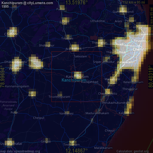
» NASA, Earths city lights 1995
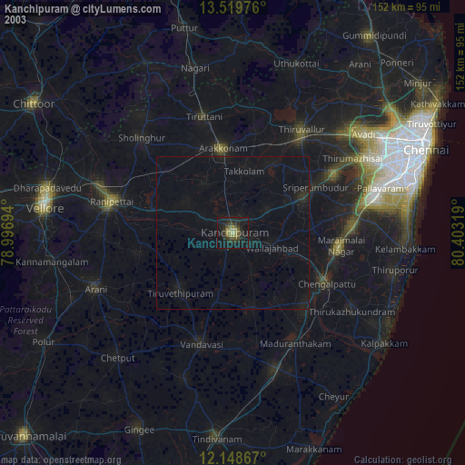
» NASA city lights 2003
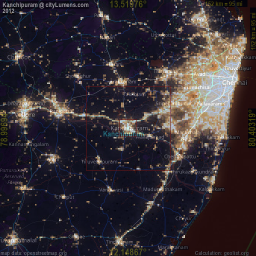
» Earth at Night: Flat Maps 2012, 2016