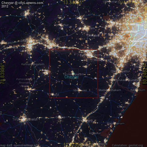
Cheyyar night lights from space
Night Light of Cheyyar (Tamil Nadu) from space (India) Src. Average luminocity for 10x10km area is 13.9199% and for 50x50km: 9.5457%.
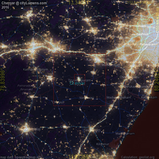
Analysis of Cheyyar night lights 2016
Square area 10x10 km:
 0%
0%90-99
2.6%80-89
2.16%70-79
1.3%60-69
2.16%50-59
1.3%40-49
4.11%30-39
2.38%20-29
2.38%10-19
3.46%0-9
78.14%Square area 50x50 km:
0.18%90-99
0.99%80-89
1.61%70-79
1.01%60-69
0.9%50-59
1.68%40-49
2.52%30-39
2.47%20-29
3.32%10-19
6.54%0-9
78.76%Clear (daylight) street map image can be seen on geolist.org.
Map coordinates:
13° 20' 44.2" North, 78° 50' 23.9" East
12° 39' 37.9" North, 79° 32' 35.1" East
11° 58' 24.9" North, 80° 14' 46.4" East
Some cities around Cheyyar sort by population:
• Kanchipuram
25.8 km =16 mi,  41°
41°
• Arni
28 km =17.4 mi,  271°
271°
• Vandavāsi
18.6 km =11.6 mi,  158°
158°
• Uttiramerūr
23.8 km =14.8 mi,  102°
102°
• Kalavai
18.1 km =11.2 mi,  312°
312°
• Peranamallūr
15.6 km =9.7 mi,  229°
229°
• Desūr
25.7 km =16 mi,  195°
195°
• Dūsi
19.5 km =12.1 mi,  48°
48°
1254322 (p: 36,527)
Sources (retrieved 2019-11-25):
» Earth at Night: Flat Maps 2012, 2016