Kalavai night lights from space
Night Light of Kalavai (Tamil Nadu) from space (India) Src. Average luminocity for 10x10km area is 4.6494% and for 50x50km: 16.5303%.
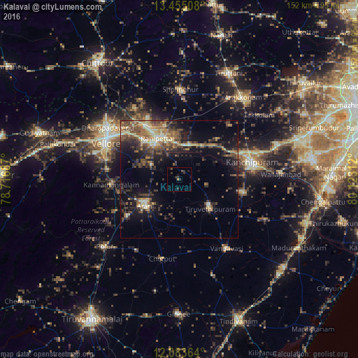
Analysis of Kalavai night lights 2016
Square area 10x10 km:
 0%
0%90-99
0%80-89
0%70-79
0.65%60-69
0.22%50-59
0%40-49
1.73%30-39
3.46%20-29
3.68%10-19
2.6%0-9
87.66%Square area 50x50 km:
0.06%90-99
2.02%80-89
2.82%70-79
1.67%60-69
2.23%50-59
3.44%40-49
4.54%30-39
4.24%20-29
5.2%10-19
10.98%0-9
62.8%Clear (daylight) street map image can be seen on geolist.org.
Map coordinates:
13° 27' 18.3" North, 78° 43' 0.7" East
12° 46' 13" North, 79° 25' 12" East
12° 5' 1.1" North, 80° 7' 23.2" East
Some cities around Kalavai sort by population:
• Vellore
35.2 km =21.9 mi,  297°
297°
• Kanchipuram
31.2 km =19.4 mi,  76°
76°
• Arni
18.5 km =11.5 mi,  232°
232°
• Arcot
18.6 km =11.6 mi,  323°
323°
• Cheyyar
18.1 km =11.2 mi,  132°
132°
• Walajapet
18.2 km =11.3 mi,  341°
341°
• Peranamallūr
22.3 km =13.9 mi,  176°
176°
• Dūsi
28.1 km =17.5 mi,  88°
88°
1268449 (p: 10,057)
Sources (retrieved 2019-11-25):
» Earth at Night: Flat Maps 2012, 2016