Kādīpur night lights from space
Night Light of Kādīpur (Uttar Pradesh) from space (India) Src. Average luminocity for 10x10km area is 17.9008% and for 50x50km: 12.7288%.
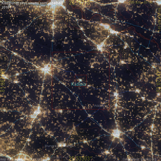
Analysis of Kādīpur night lights 2016
Square area 10x10 km:
 0.99%
0.99%90-99
0.6%80-89
0.6%70-79
0.2%60-69
1.59%50-59
4.56%40-49
5.56%30-39
7.74%20-29
9.52%10-19
10.71%0-9
57.94%Square area 50x50 km:
0.09%90-99
0.12%80-89
0.35%70-79
0.73%60-69
1.36%50-59
2.52%40-49
4.03%30-39
5.67%20-29
7.59%10-19
11.56%0-9
65.99%Clear (daylight) street map image can be seen on geolist.org.
Map coordinates:
26° 47' 49.7" North, 81° 40' 1.8" East
26° 10' 4" North, 82° 22' 13" East
25° 32' 6.1" North, 83° 4' 24.3" East
Some cities around Kādīpur sort by population:
• Sultānpur
31.3 km =19.4 mi,  288°
288°
• Bela
46.4 km =28.8 mi,  233°
233°
• Akbarpur
33.4 km =20.8 mi,  29°
29°
• Jalālpur
40.1 km =24.9 mi,  66°
66°
• Shāhganj
34 km =21.1 mi,  112°
112°
• Goshāinganj
44.9 km =27.9 mi,  1°
1°
• Dostpur
15.6 km =9.7 mi,  40°
40°
• Patti
32.2 km =20 mi,  211°
211°
1268677 (p: 7,472)
Sources (retrieved 2019-11-25):
» Earth at Night: Flat Maps 2012, 2016