Jumri Tilaiyā night lights from space
Night Light of Jumri Tilaiyā (Jharkhand) from space (India) Src. Average luminocity for 10x10km area is 61.7758% and for 50x50km: 18.0158%.
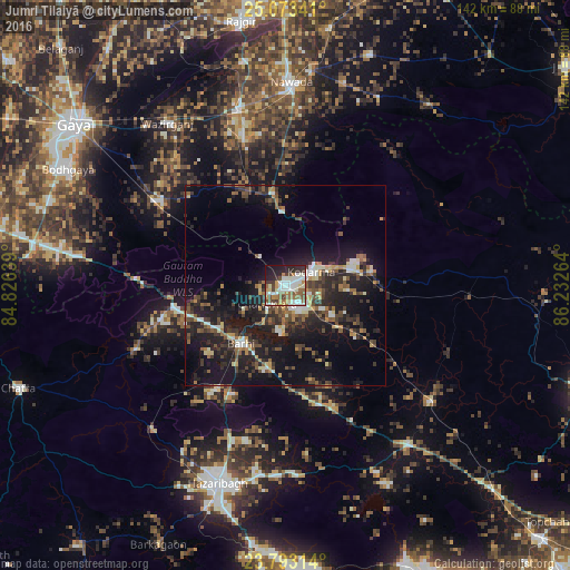
Analysis of Jumri Tilaiyā night lights 2016
Square area 10x10 km:
 13.89%
90-99
18.06%80-89
4.96%70-79
6.15%60-69
8.93%50-59
9.92%40-49
8.13%30-39
6.75%20-29
12.9%10-19
9.72%0-9
0.6%Square area 50x50 km:
1.69%90-99
2.4%80-89
1.5%70-79
1.77%60-69
2.04%50-59
2.73%40-49
3.79%30-39
4.01%20-29
7.22%10-19
17.9%0-9
54.96%Clear (daylight) street map image can be seen on geolist.org.
Map coordinates:
25° 4' 24.3" North, 84° 49' 35" East
24° 26' 5.6" North, 85° 31' 46.2" East
23° 47' 35.3" North, 86° 13' 57.5" East
Some cities around Jumri Tilaiyā sort by population:
• Hazāribāgh
52.1 km =32.4 mi,  199°
199°
• Nawāda
50.3 km =31.3 mi,  1°
1°
• Bagaha
48.6 km =30.2 mi,  282°
282°
• Hisuā
45.8 km =28.5 mi,  345°
345°
• Barki Saria
46.5 km =28.9 mi,  128°
128°
• Kodarmā
7.5 km =4.7 mi,  60°
60°
• patamda
18.9 km =11.7 mi,  217°
217°
• Dhanwār
45.9 km =28.5 mi,  93°
93°
1268775 (p: 76,341)
Sources (retrieved 2019-11-25):
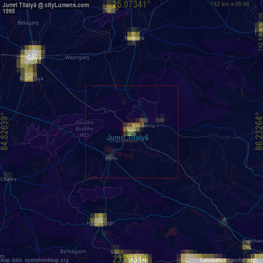
» NASA, Earths city lights 1995
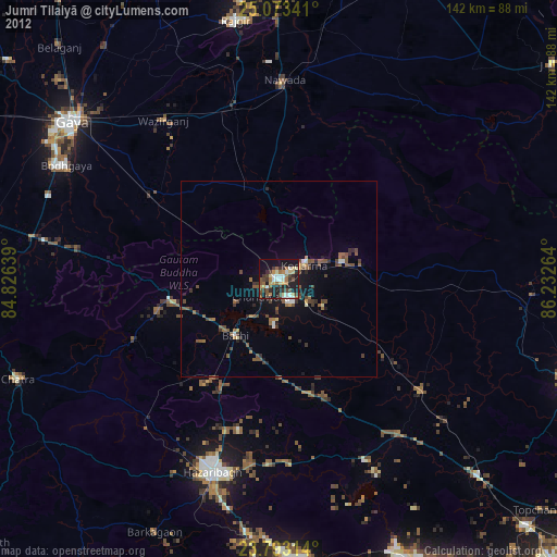
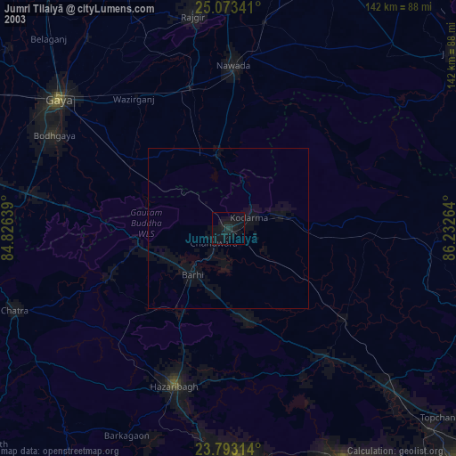
» NASA city lights 2003
» Earth at Night: Flat Maps 2012, 2016