Hazāribāgh night lights from space
Night Light of Hazāribāgh (Jharkhand) from space (India) Src. Average luminocity for 10x10km area is 80.8295% and for 50x50km: 20.6069%.
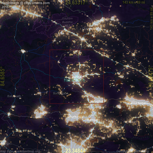
Analysis of Hazāribāgh night lights 2016
Square area 10x10 km:
 31.06%
90-99
28.98%80-89
4.17%70-79
2.65%60-69
6.63%50-59
7.77%40-49
9.28%30-39
8.9%20-29
0.57%10-19
0%0-9
0%Square area 50x50 km:
3.34%90-99
4.13%80-89
1.77%70-79
1.56%60-69
2.24%50-59
2.96%40-49
3.33%30-39
3.99%20-29
6.61%10-19
12.85%0-9
57.21%Clear (daylight) street map image can be seen on geolist.org.
Map coordinates:
24° 37' 59.4" North, 84° 39' 30.6" East
23° 59' 32.7" North, 85° 21' 41.8" East
23° 20' 54.4" North, 86° 3' 53.1" East
Some cities around Hazāribāgh sort by population:
• Rāmgarh
43.4 km =27 mi,  157°
157°
• Jumri Tilaiyā
52.1 km =32.4 mi,  19°
19°
• Gumia
51.9 km =32.2 mi,  114°
114°
• Kuju
33.3 km =20.7 mi,  153°
153°
• Barkā Kānā
42.7 km =26.5 mi,  165°
165°
• patamda
34.7 km =21.6 mi,  9°
9°
• Hesla
53.1 km =33 mi,  81°
81°
• Rāy
46.4 km =28.8 mi,  222°
222°
1270164 (p: 140,063)
Sources (retrieved 2019-11-25):
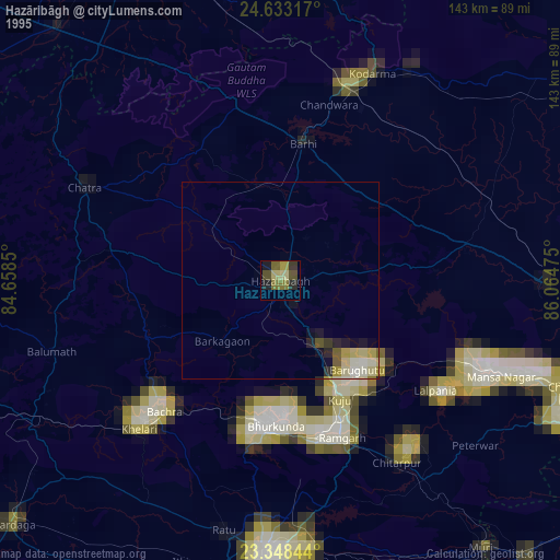
» NASA, Earths city lights 1995
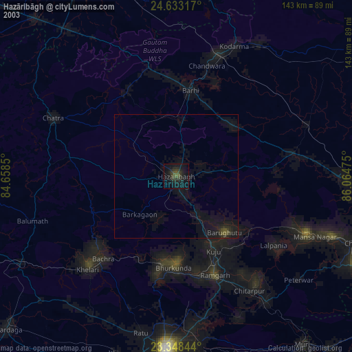
» NASA city lights 2003
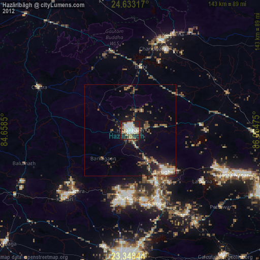
» Earth at Night: Flat Maps 2012, 2016