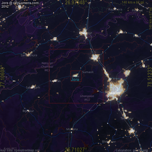
Jora night lights from space
Night Light of Jora (Madhya Pradesh) from space (India) Src. Average luminocity for 10x10km area is 20.3295% and for 50x50km: 7.2075%.
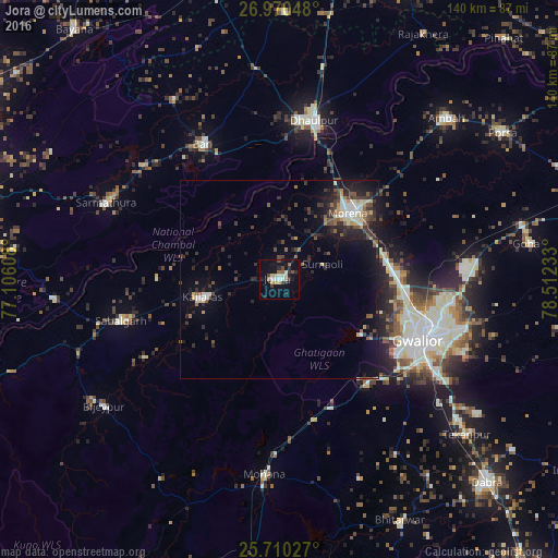
Analysis of Jora night lights 2016
Square area 10x10 km:
 2.27%
2.27%90-99
3.03%80-89
3.03%70-79
1.52%60-69
2.65%50-59
1.89%40-49
2.65%30-39
1.89%20-29
5.87%10-19
17.23%0-9
57.95%Square area 50x50 km:
0.65%90-99
0.97%80-89
0.76%70-79
0.42%60-69
0.73%50-59
0.98%40-49
1.47%30-39
1.75%20-29
2.56%10-19
5.76%0-9
83.94%Clear (daylight) street map image can be seen on geolist.org.
Map coordinates:
26° 58' 13.7" North, 77° 6' 21.9" East
26° 20' 31.5" North, 77° 48' 33.1" East
25° 42' 37" North, 78° 30' 44.4" East
Some cities around Jora sort by population:
• Gwalior
38.4 km =23.9 mi,  108°
108°
• Morena
25.4 km =15.8 mi,  46°
46°
• Dhaulpur
39.6 km =24.6 mi,  10°
10°
• Bāri
38.9 km =24.2 mi,  330°
330°
• Morār
43.4 km =27 mi, 107°
• Sabalgarh
41.3 km =25.7 mi,  255°
255°
• Kailāras
19.7 km =12.2 mi, 257°
• Antri
51 km =31.7 mi,  128°
128°
1268823 (p: 26,338)
Sources (retrieved 2019-11-25):
» Earth at Night: Flat Maps 2012, 2016