Jhīnjhak night lights from space
Night Light of Jhīnjhak (Uttar Pradesh) from space (India) Src. Average luminocity for 10x10km area is 15.9583% and for 50x50km: 11.7363%.
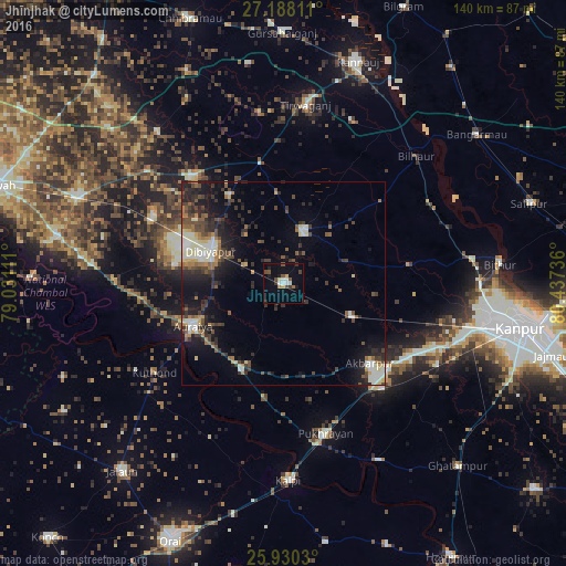
Analysis of Jhīnjhak night lights 2016
Square area 10x10 km:
 2.08%
2.08%90-99
2.46%80-89
0.76%70-79
1.52%60-69
1.14%50-59
2.65%40-49
3.22%30-39
2.65%20-29
2.08%10-19
5.3%0-9
76.14%Square area 50x50 km:
1.19%90-99
2.17%80-89
1.01%70-79
0.79%60-69
1.43%50-59
1.64%40-49
2.48%30-39
2.69%20-29
3.68%10-19
7.25%0-9
75.68%Clear (daylight) street map image can be seen on geolist.org.
Map coordinates:
27° 11' 17.2" North, 79° 1' 52" East
26° 33' 39.3" North, 79° 44' 3.2" East
25° 55' 49.1" North, 80° 26' 14.5" East
Some cities around Jhīnjhak sort by population:
• Auraiya
24.8 km =15.4 mi,  244°
244°
• Bidhūna
34.9 km =21.7 mi,  320°
320°
• Pukhrāyān
38.9 km =24.2 mi,  164°
164°
• Akbarpur
29.1 km =18.1 mi,  132°
132°
• Indergarh
42.1 km =26.2 mi,  351°
351°
• Phaphūnd
27.2 km =16.9 mi,  278°
278°
• Rura
18.4 km =11.4 mi,  115°
115°
• Sikandra
23.9 km =14.9 mi,  205°
205°
1268962 (p: 23,499)
Sources (retrieved 2019-11-25):
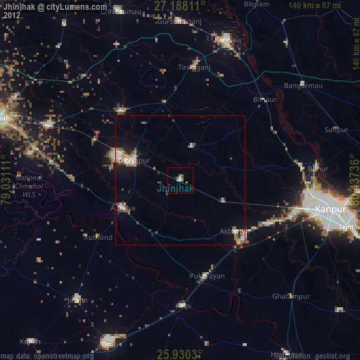
» Earth at Night: Flat Maps 2012, 2016