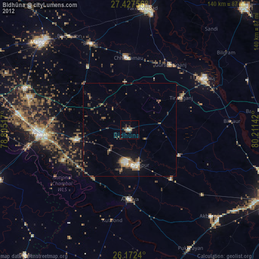
Bidhūna night lights from space
Night Light of Bidhūna (Uttar Pradesh) from space (India) Src. Average luminocity for 10x10km area is 29.7976% and for 50x50km: 23.2998%.
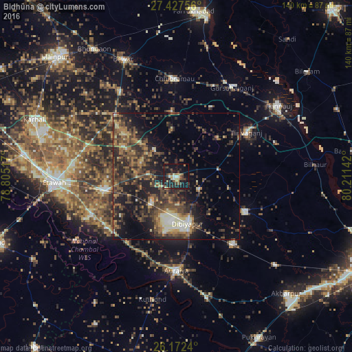
Analysis of Bidhūna night lights 2016
Square area 10x10 km:
 1.19%
1.19%90-99
3.17%80-89
4.17%70-79
2.38%60-69
5.75%50-59
3.77%40-49
7.14%30-39
4.56%20-29
13.29%10-19
43.45%0-9
11.11%Square area 50x50 km:
1.02%90-99
2.44%80-89
2.2%70-79
2.15%60-69
4.1%50-59
4.5%40-49
7.5%30-39
6.99%20-29
9.72%10-19
14.22%0-9
45.17%Clear (daylight) street map image can be seen on geolist.org.
Map coordinates:
27° 25' 39.2" North, 78° 48' 18.6" East
26° 48' 6.2" North, 79° 30' 29.8" East
26° 10' 20.6" North, 80° 12' 41.1" East
Some cities around Bidhūna sort by population:
• Bharthana
29 km =18 mi,  259°
259°
• Jhīnjhak
34.9 km =21.7 mi,  140°
140°
• Indergarh
21.9 km =13.6 mi,  47°
47°
• Phaphūnd
23 km =14.3 mi,  190°
190°
• Bakewar
36.4 km =22.6 mi,  244°
244°
• Saurikh
25.5 km =15.8 mi,  355°
355°
• Tālgrām
30.6 km =19 mi,  26°
26°
• Kishni
34.8 km =21.6 mi,  315°
315°
1275732 (p: 27,158)
Sources (retrieved 2019-11-25):
» Earth at Night: Flat Maps 2012, 2016