Indergarh night lights from space
Night Light of Indergarh (Uttar Pradesh) from space (India) Src. Average luminocity for 10x10km area is 8.9623% and for 50x50km: 10.731%.
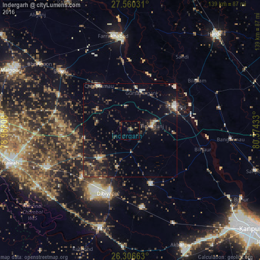
Analysis of Indergarh night lights 2016
Square area 10x10 km:
 0%
0%90-99
0%80-89
1.39%70-79
0.2%60-69
0.79%50-59
2.38%40-49
2.98%30-39
1.19%20-29
5.75%10-19
3.97%0-9
81.35%Square area 50x50 km:
0.57%90-99
1.03%80-89
0.78%70-79
0.58%60-69
1.04%50-59
1.59%40-49
2.98%30-39
3.62%20-29
4.37%10-19
8.31%0-9
75.12%Clear (daylight) street map image can be seen on geolist.org.
Map coordinates:
27° 33' 37.1" North, 78° 58' 5.1" East
26° 56' 6.8" North, 79° 40' 16.3" East
26° 18' 23.9" North, 80° 22' 27.6" East
Some cities around Indergarh sort by population:
• Kannauj
27.9 km =17.3 mi,  61°
61°
• Chhibrāmau
29.1 km =18.1 mi,  324°
324°
• Gursahāiganj
20.9 km =13 mi,  16°
16°
• Bidhūna
21.9 km =13.6 mi,  227°
227°
• Bilhaur
40.3 km =25 mi,  104°
104°
• Kamalganj
36.5 km =22.7 mi,  353°
353°
• Saurikh
21 km =13 mi,  300°
300°
• Tālgrām
12.7 km =7.9 mi, 349°
1269752 (p: 17,366)
Sources (retrieved 2019-11-25):
» Earth at Night: Flat Maps 2012, 2016