Jharia night lights from space
Night Light of Jharia (Jharkhand) from space (India) Src. Average luminocity for 10x10km area is 99.1409% and for 50x50km: 49.2246%.
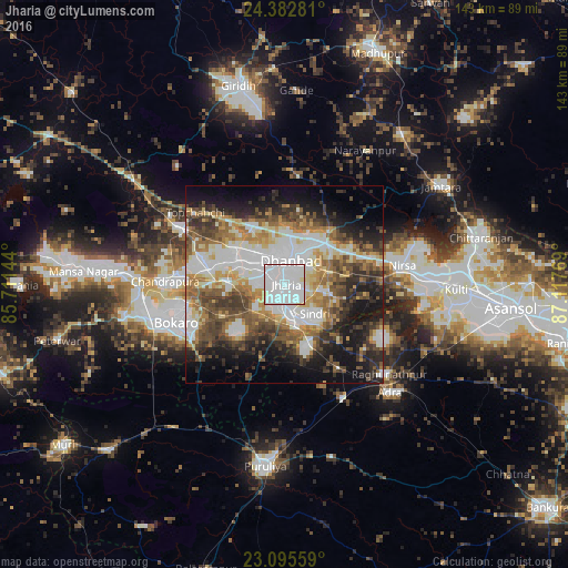
Analysis of Jharia night lights 2016
Square area 10x10 km:
 76.59%
90-99
20.83%80-89
1.98%70-79
0.6%60-69
0%50-59
0%40-49
0%30-39
0%20-29
0%10-19
0%0-9
0%Square area 50x50 km:
11.87%90-99
10.61%80-89
5.07%70-79
5.48%60-69
6.71%50-59
6.99%40-49
8.06%30-39
7.4%20-29
8.13%10-19
13%0-9
16.69%Clear (daylight) street map image can be seen on geolist.org.
Map coordinates:
24° 22' 58.1" North, 85° 42' 41.2" East
23° 44' 26.8" North, 86° 24' 52.4" East
23° 5' 44.1" North, 87° 7' 3.7" East
Some cities around Jharia sort by population:
• Dhanbād
7.4 km =4.6 mi,  23°
23°
• Kātrās
13.4 km =8.3 mi,  298°
298°
• Pāthardih
8.5 km =5.3 mi,  168°
168°
• Jāmadoba
3.1 km =1.9 mi,  208°
208°
• Sijua
9.4 km =5.8 mi,  294°
294°
• Bagra
10 km =6.2 mi,  265°
265°
• Bhojudih
11.6 km =7.2 mi, 166°
• Kenduadīh
5.5 km =3.4 mi,  314°
314°
1268988 (p: 86,938)
Sources (retrieved 2019-11-25):
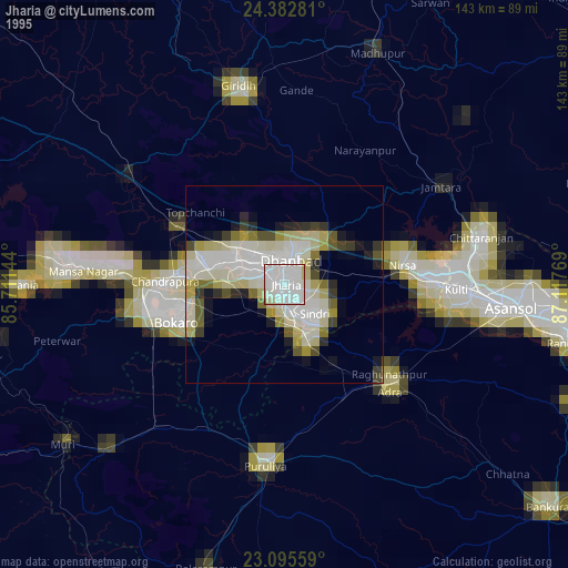
» NASA, Earths city lights 1995
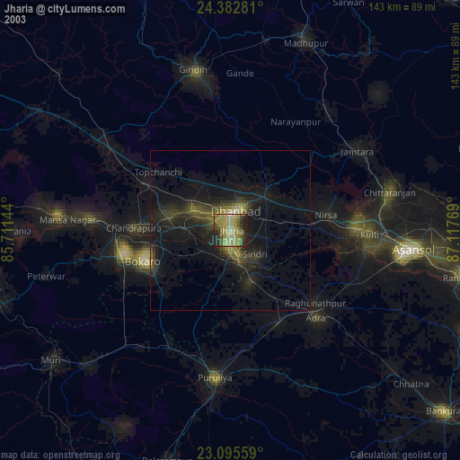
» NASA city lights 2003
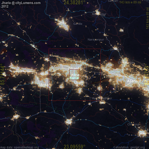
» Earth at Night: Flat Maps 2012, 2016