Sijua night lights from space
Night Light of Sijua (Jharkhand) from space (India) Src. Average luminocity for 10x10km area is 95.4444% and for 50x50km: 53.7774%.
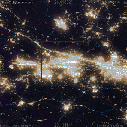
Analysis of Sijua night lights 2016
Square area 10x10 km:
100  49.21%
90-99 34.33%
80-89 5.75%
70-79 7.34%
60-69 3.37%
50-59 0%
40-49 0%
30-39 0%
20-29 0%
10-19 0%
0-9 0%
49.21%90-99
34.33%80-89
5.75%70-79
7.34%60-69
3.37%50-59
0%40-49
0%30-39
0%20-29
0%10-19
0%0-9
0%Square area 50x50 km:
100 14.71%
90-99 11.88%
80-89 5.95%
70-79 5.85%
60-69 6.99%
50-59 7.32%
40-49 8.08%
30-39 7.33%
20-29 6.53%
10-19 9.73%
0-9 15.65%
14.71%90-99
11.88%80-89
5.95%70-79
5.85%60-69
6.99%50-59
7.32%40-49
8.08%30-39
7.33%20-29
6.53%10-19
9.73%0-9
15.65%Clear (daylight) street map image can be seen on geolist.org.
Map coordinates:
24° 25' 4.9" North, 85° 37' 37.8" East
23° 46' 34.2" North, 86° 19' 49" East
23° 7' 52.1" North, 87° 2' 0.3" East
Some cities around Sijua sort by population:
• Dhanbād
11.8 km =7.3 mi,  75°
75°
• Jharia
9.4 km =5.8 mi,  114°
114°
• Kātrās
4 km =2.5 mi,  306°
306°
• Pāthardih
16 km =9.9 mi,  139°
139°
• Jāmadoba
9.7 km =6 mi,  132°
132°
• Malkera
4.4 km =2.7 mi,  278°
278°
• Bagra
5 km =3.1 mi,  196°
196°
• Kenduadīh
4.7 km =2.9 mi,  90°
90°
1256335 (p: 31,537)
Sources (retrieved 2019-11-25):
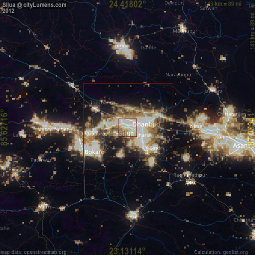
» Earth at Night: Flat Maps 2012, 2016