Jatani night lights from space
Night Light of Jatani (Odisha) from space (India) Src. Average luminocity for 10x10km area is 67.7123% and for 50x50km: 31.1934%.
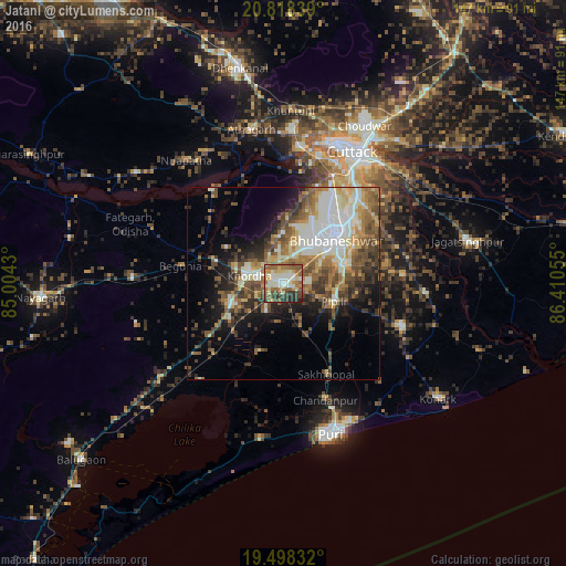
Analysis of Jatani night lights 2016
Square area 10x10 km:
 6.15%
6.15%90-99
22.82%80-89
7.94%70-79
8.33%60-69
14.88%50-59
17.66%40-49
8.13%30-39
8.13%20-29
5.95%10-19
0%0-9
0%Square area 50x50 km:
4.1%90-99
7.91%80-89
3.1%70-79
3.54%60-69
4.87%50-59
6.29%40-49
5.74%30-39
4.5%20-29
5.54%10-19
8.94%0-9
45.44%Clear (daylight) street map image can be seen on geolist.org.
Map coordinates:
20° 49' 6.2" North, 85° 0' 15.5" East
20° 9' 35.1" North, 85° 42' 26.7" East
19° 29' 54" North, 86° 24' 38" East
Some cities around Jatani sort by population:
• Bhubaneshwar
18.2 km =11.3 mi,  46°
46°
• Cuttack
38.4 km =23.9 mi,  27°
27°
• Puri
42 km =26.1 mi,  163°
163°
• Khurda
9.8 km =6.1 mi,  285°
285°
• Nimāparha
33 km =20.5 mi,  110°
110°
• Āthagarh
40.9 km =25.4 mi,  348°
348°
• Bānki
30.6 km =19 mi,  322°
322°
• Pipili
13.9 km =8.6 mi, 111°
1269154 (p: 56,003)
Sources (retrieved 2019-11-25):
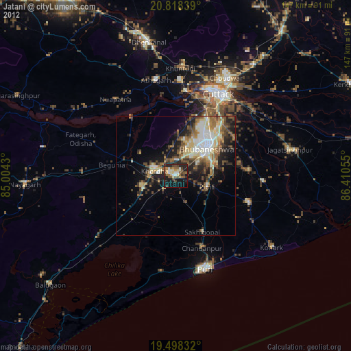
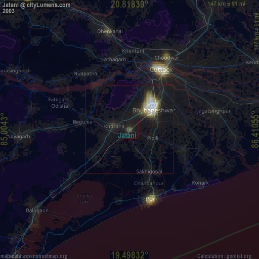
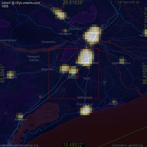
» NASA, Earths city lights 1995
» NASA city lights 2003
» Earth at Night: Flat Maps 2012, 2016