Jāmuria night lights from space
Night Light of Jāmuria (West Bengal) from space (India) Src. Average luminocity for 10x10km area is 85.1032% and for 50x50km: 54.2185%.
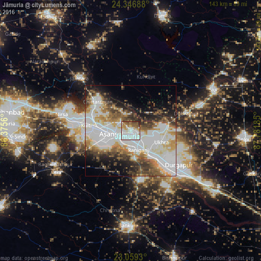
Analysis of Jāmuria night lights 2016
Square area 10x10 km:
 24.21%
90-99
39.29%80-89
7.34%70-79
4.17%60-69
7.94%50-59
10.91%40-49
3.97%30-39
1.39%20-29
0.79%10-19
0%0-9
0%Square area 50x50 km:
16.09%90-99
16.68%80-89
4.71%70-79
4.52%60-69
5.3%50-59
5.96%40-49
6.15%30-39
5.69%20-29
6.29%10-19
8.19%0-9
20.41%Clear (daylight) street map image can be seen on geolist.org.
Map coordinates:
24° 20' 48.8" North, 86° 22' 32.2" East
23° 42' 16.8" North, 87° 4' 43.4" East
23° 3' 33.5" North, 87° 46' 54.7" East
Some cities around Jāmuria sort by population:
• Durgapur
31.4 km =19.5 mi,  131°
131°
• Āsansol
10 km =6.2 mi,  256°
256°
• Kulti
24.1 km =15 mi,  277°
277°
• Rānīganj
11.1 km =6.9 mi,  151°
151°
• Chittaranjan
24.6 km =15.3 mi,  313°
313°
• Dubrājpur
31.8 km =19.8 mi,  72°
72°
• Bahula
10.6 km =6.6 mi,  123°
123°
• Barjora
37.6 km =23.4 mi, 145°
1269280 (p: 160,242)
Sources (retrieved 2019-11-25):
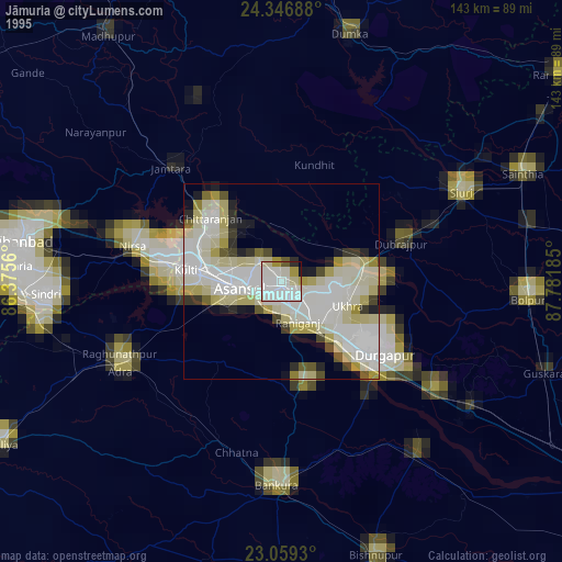
» NASA, Earths city lights 1995
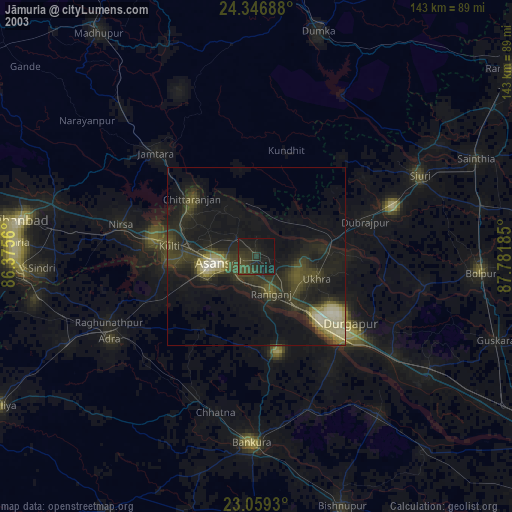
» NASA city lights 2003
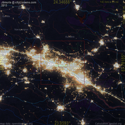
» Earth at Night: Flat Maps 2012, 2016