Durgapur night lights from space
Night Light of Durgapur (West Bengal) from space (India) Src. Average luminocity for 10x10km area is 97.2897% and for 50x50km: 52.7523%.
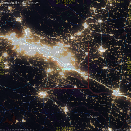
Analysis of Durgapur night lights 2016
Square area 10x10 km:
 62.3%
62.3%90-99
28.57%80-89
3.97%70-79
3.57%60-69
1.59%50-59
0%40-49
0%30-39
0%20-29
0%10-19
0%0-9
0%Square area 50x50 km:
11.15%90-99
15.05%80-89
5.05%70-79
4.59%60-69
5.44%50-59
7.9%40-49
8.63%30-39
7.36%20-29
10.34%10-19
14.98%0-9
9.51%Clear (daylight) street map image can be seen on geolist.org.
Map coordinates:
24° 9' 32.3" North, 86° 36' 17.6" East
23° 30' 57" North, 87° 18' 28.8" East
22° 52' 10.3" North, 88° 0' 40.1" East
Some cities around Durgapur sort by population:
• Āsansol
38 km =23.6 mi,  299°
299°
• Jāmuria
31.4 km =19.5 mi,  311°
311°
• Rānīganj
21.3 km =13.2 mi, 301°
• Dubrājpur
31.3 km =19.4 mi,  12°
12°
• Sonāmukhi
25.8 km =16 mi,  155°
155°
• Bahula
21 km =13 mi,  315°
315°
• Barjora
10 km =6.2 mi,  190°
190°
• Beliātor
23.5 km =14.6 mi,  202°
202°
1272175 (p: 518,872)
Sources (retrieved 2019-11-25):
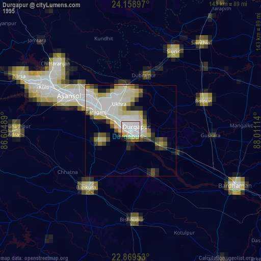
» NASA, Earths city lights 1995
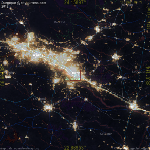
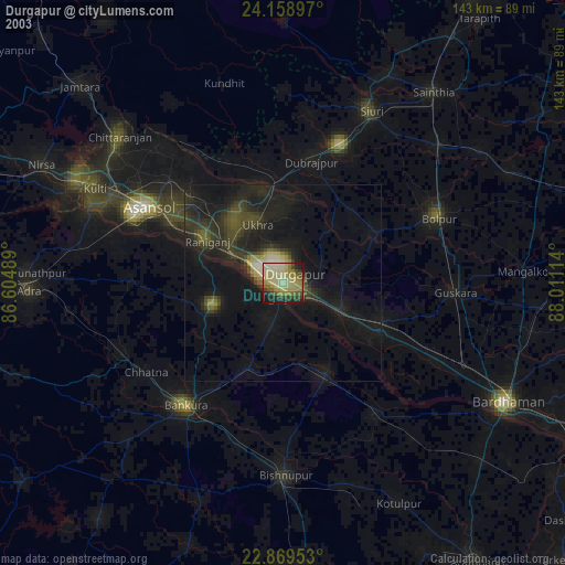
» NASA city lights 2003
» Earth at Night: Flat Maps 2012, 2016