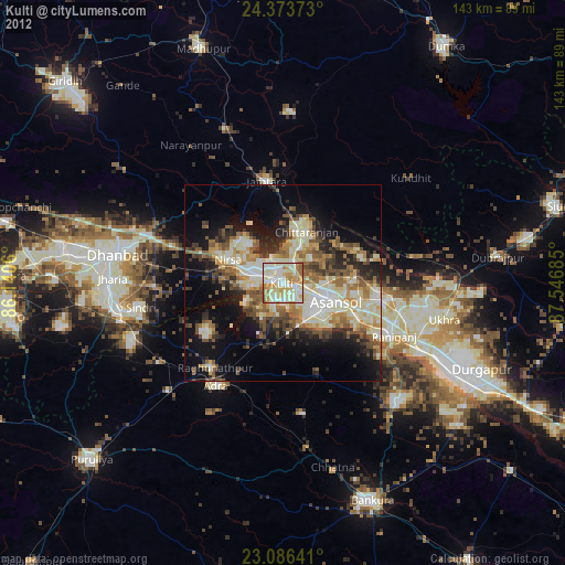
Kulti night lights from space
Night Light of Kulti (West Bengal) from space (India) Src. Average luminocity for 10x10km area is 96.9921% and for 50x50km: 47.2751%.

Analysis of Kulti night lights 2016
Square area 10x10 km:
 51.59%
90-99
37.3%80-89
7.94%70-79
2.58%60-69
0.6%50-59
0%40-49
0%30-39
0%20-29
0%10-19
0%0-9
0%Square area 50x50 km:
12.58%90-99
11.82%80-89
4.15%70-79
4.21%60-69
5.27%50-59
5.84%40-49
5.82%30-39
6.76%20-29
9.93%10-19
14.88%0-9
18.74%Clear (daylight) street map image can be seen on geolist.org.
Map coordinates:
24° 22' 25.4" North, 86° 8' 26.2" East
23° 43' 54" North, 86° 50' 37.4" East
23° 5' 11.1" North, 87° 32' 48.7" East
Some cities around Kulti sort by population:
• Āsansol
15.2 km =9.4 mi,  110°
110°
• Jāmuria
24.1 km =15 mi,  97°
97°
• Chittaranjan
15.2 km =9.4 mi,  23°
23°
• Lakhyabad
19.4 km =12.1 mi,  248°
248°
• Jāmtāra
26.1 km =16.2 mi,  350°
350°
• Raghunathpur
27.6 km =17.1 mi,  218°
218°
• Adra
30.8 km =19.1 mi,  211°
211°
• Nirsā
15.1 km =9.4 mi,  292°
292°
1265711 (p: 305,405)
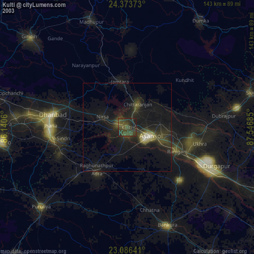
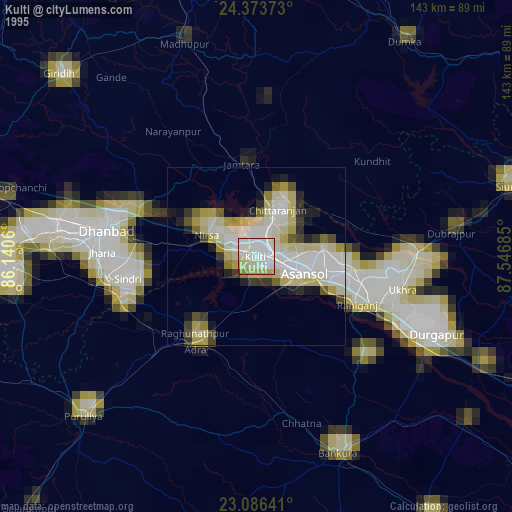
Sources (retrieved 2019-11-25):
» NASA, Earths city lights 1995
» NASA city lights 2003
» Earth at Night: Flat Maps 2012, 2016