Āsansol night lights from space
Night Light of Āsansol (West Bengal) from space (India) Src. Average luminocity for 10x10km area is 97.994% and for 50x50km: 52.0679%.
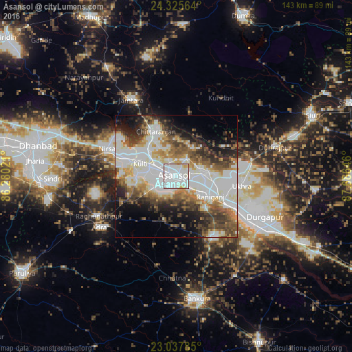
Analysis of Āsansol night lights 2016
Square area 10x10 km:
 57.14%
90-99
37.1%80-89
3.17%70-79
2.58%60-69
0%50-59
0%40-49
0%30-39
0%20-29
0%10-19
0%0-9
0%Square area 50x50 km:
14.98%90-99
15.25%80-89
4.35%70-79
3.83%60-69
5.62%50-59
6.42%40-49
6.72%30-39
6.18%20-29
6.95%10-19
8.74%0-9
20.96%Clear (daylight) street map image can be seen on geolist.org.
Map coordinates:
24° 19' 32.3" North, 86° 16' 48.8" East
23° 40' 60" North, 86° 58' 60" East
23° 2' 16.3" North, 87° 41' 11.3" East
Some cities around Āsansol sort by population:
• Kulti
15.2 km =9.4 mi,  290°
290°
• Jāmuria
10 km =6.2 mi,  76°
76°
• Rānīganj
16.7 km =10.4 mi,  116°
116°
• Chittaranjan
20.9 km =13 mi,  337°
337°
• Lakhyabad
32.3 km =20.1 mi,  266°
266°
• Raghunathpur
35.4 km =22 mi,  243°
243°
• Bahula
18.8 km =11.7 mi,  100°
100°
• Nirsā
30.3 km =18.8 mi, 291°
1278314 (p: 504,271)
Sources (retrieved 2019-11-25):
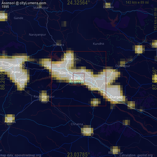
» NASA, Earths city lights 1995
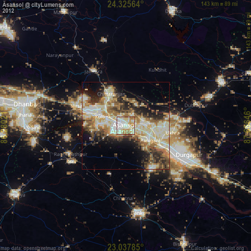
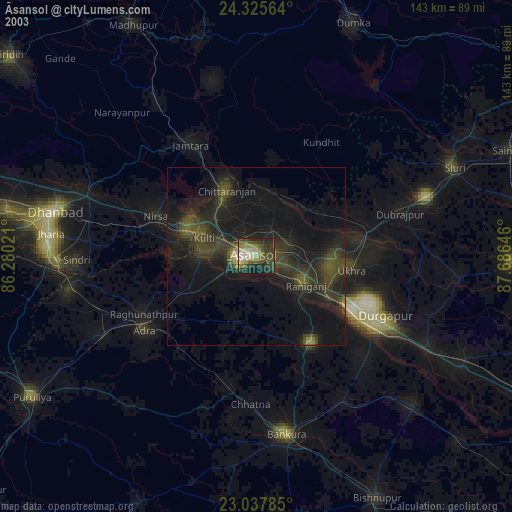
» NASA city lights 2003
» Earth at Night: Flat Maps 2012, 2016