Jaisinghnagar night lights from space
Night Light of Jaisinghnagar (Madhya Pradesh) from space (India) Src. Average luminocity for 10x10km area is 2.4464% and for 50x50km: 0.2934%.
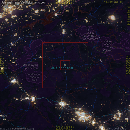
Analysis of Jaisinghnagar night lights 2016
Square area 10x10 km:
 0%
0%90-99
0%80-89
0.79%70-79
0%60-69
0.79%50-59
0%40-49
0.6%30-39
1.19%20-29
1.39%10-19
0%0-9
95.24%Square area 50x50 km:
0%90-99
0%80-89
0.03%70-79
0%60-69
0.06%50-59
0.03%40-49
0.08%30-39
0.24%20-29
0.17%10-19
0.1%0-9
99.29%Clear (daylight) street map image can be seen on geolist.org.
Map coordinates:
24° 19' 41.2" North, 80° 41' 15.8" East
23° 41' 9" North, 81° 23' 27.1" East
23° 2' 25.3" North, 82° 5' 38.3" East
Some cities around Jaisinghnagar sort by population:
• Shahdol
43.7 km =27.2 mi,  183°
183°
• Umaria
59.2 km =36.8 mi,  252°
252°
• Beohāri
37.6 km =23.4 mi,  358°
358°
• Pāli
50.3 km =31.3 mi,  224°
224°
• Burhar
54.3 km =33.7 mi,  164°
164°
• Bodri
58 km =36 mi, 175°
• Chandia
69.5 km =43.2 mi,  267°
267°
• Barhi
63.4 km =39.4 mi,  292°
292°
1269503 (p: 7,600)
Sources (retrieved 2019-11-25):
» Earth at Night: Flat Maps 2012, 2016