Bodri night lights from space
Night Light of Bodri (Madhya Pradesh) from space (India) Src. Average luminocity for 10x10km area is 11.0284% and for 50x50km: 10.1015%.
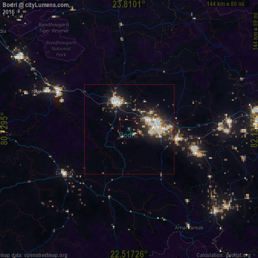
Analysis of Bodri night lights 2016
Square area 10x10 km:
 0%
0%90-99
1.14%80-89
0.38%70-79
2.84%60-69
1.7%50-59
1.33%40-49
2.08%30-39
2.08%20-29
2.84%10-19
7.95%0-9
77.65%Square area 50x50 km:
1.58%90-99
1.94%80-89
0.69%70-79
0.99%60-69
0.68%50-59
1.48%40-49
1.67%30-39
2.04%20-29
3.49%10-19
7.6%0-9
77.84%Clear (daylight) street map image can be seen on geolist.org.
Map coordinates:
23° 48' 36.4" North, 80° 43' 46.2" East
23° 9' 54.9" North, 81° 25' 57.4" East
22° 31' 2.1" North, 82° 8' 8.7" East
Some cities around Bodri sort by population:
• Shahdol
16 km =9.9 mi,  333°
333°
• Kotma
56 km =34.8 mi,  85°
85°
• Pāli
45.5 km =28.3 mi,  299°
299°
• Dindori
43.8 km =27.2 mi,  235°
235°
• Burhar
11.6 km =7.2 mi,  61°
61°
• Anūppur
27.3 km =17 mi,  104°
104°
• Shāhpur
46.6 km =29 mi,  250°
250°
• Jaisinghnagar
58 km =36 mi,  355°
355°
1275384 (p: 14,491)
Sources (retrieved 2019-11-25):
» Earth at Night: Flat Maps 2012, 2016