Hojāi night lights from space
Night Light of Hojāi (Assam) from space (India) Src. Average luminocity for 10x10km area is 24.2639% and for 50x50km: 4.8133%.
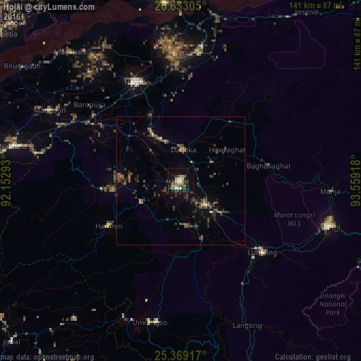
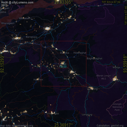
Analysis of Hojāi night lights 2016
Square area 10x10 km:
 0.6%
0.6%90-99
3.97%80-89
1.98%70-79
3.97%60-69
2.98%50-59
5.36%40-49
5.75%30-39
3.37%20-29
4.56%10-19
22.22%0-9
45.24%Square area 50x50 km:
0.07%90-99
0.27%80-89
0.24%70-79
0.33%60-69
0.59%50-59
0.95%40-49
1.73%30-39
1.59%20-29
1.66%10-19
2.9%0-9
89.66%Clear (daylight) street map image can be seen on geolist.org.
Map coordinates:
26° 37' 59" North, 92° 9' 10.5" East
26° 0' 10.1" North, 92° 51' 21.8" East
25° 22' 9" North, 93° 33' 33" East
Some cities around Hojāi sort by population:
• Dimāpur
87.1 km =54.1 mi,  96°
96°
• Tezpur
70.3 km =43.7 mi,  355°
355°
• Diphu
60.2 km =37.4 mi,  107°
107°
• Lumding Railway Colony
42.2 km =26.2 mi,  131°
131°
• Dhekiajuli
86.6 km =53.8 mi,  334°
334°
• Dhing
64.3 km =40 mi,  323°
323°
• Morigaon
57.7 km =35.9 mi,  298°
298°
• Maibong
83 km =51.6 mi,  160°
160°
1269993 (p: 36,869)
Sources (retrieved 2019-11-25):
» Earth at Night: Flat Maps 2012, 2016