Lumding Railway Colony night lights from space
Night Light of Lumding Railway Colony (Assam) from space (India) Src. Average luminocity for 10x10km area is 10.5644% and for 50x50km: 1.6972%.
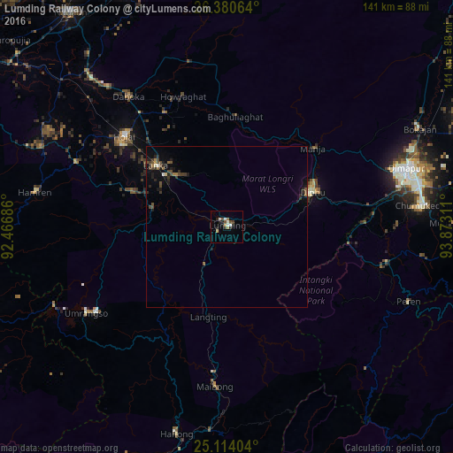
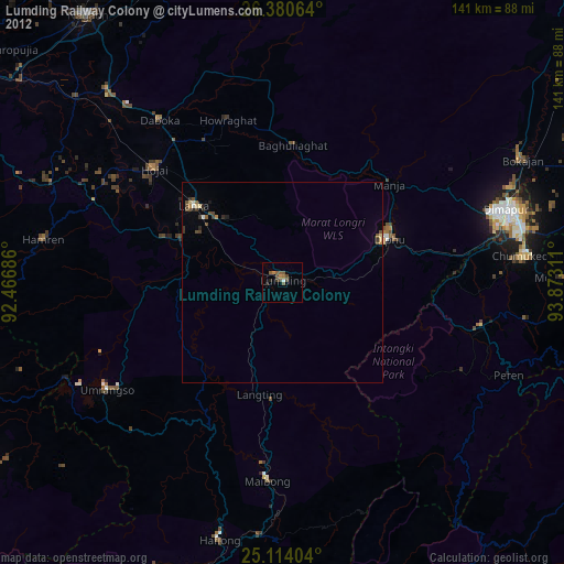
Analysis of Lumding Railway Colony night lights 2016
Square area 10x10 km:
 1.33%
1.33%90-99
2.46%80-89
0.76%70-79
0.76%60-69
1.52%50-59
0.95%40-49
1.89%30-39
0.95%20-29
3.03%10-19
2.27%0-9
84.09%Square area 50x50 km:
0.08%90-99
0.16%80-89
0.08%70-79
0.06%60-69
0.24%50-59
0.29%40-49
0.52%30-39
0.35%20-29
0.65%10-19
0.95%0-9
96.6%Clear (daylight) street map image can be seen on geolist.org.
Map coordinates:
26° 22' 50.3" North, 92° 28' 0.7" East
25° 44' 56.5" North, 93° 10' 11.9" East
25° 6' 50.5" North, 93° 52' 23.2" East
Some cities around Lumding Railway Colony sort by population:
• Dimāpur
58.1 km =36.1 mi,  71°
71°
• Diphu
28.2 km =17.5 mi, 68°
• Hāflong
66.7 km =41.4 mi,  193°
193°
• Hojāi
42.2 km =26.2 mi,  311°
311°
• Bokajān
68.1 km =42.3 mi,  63°
63°
• Maibong
49.9 km =31 mi,  183°
183°
• Barpathār
93.4 km =58 mi,  50°
50°
• Mahur
63.2 km =39.3 mi, 185°
7302859 (p: 25,283)
Sources (retrieved 2019-11-25):
» Earth at Night: Flat Maps 2012, 2016