Hisar night lights from space
Night Light of Hisar (Haryana) from space (India) Src. Average luminocity for 10x10km area is 72.4087% and for 50x50km: 9.0511%.
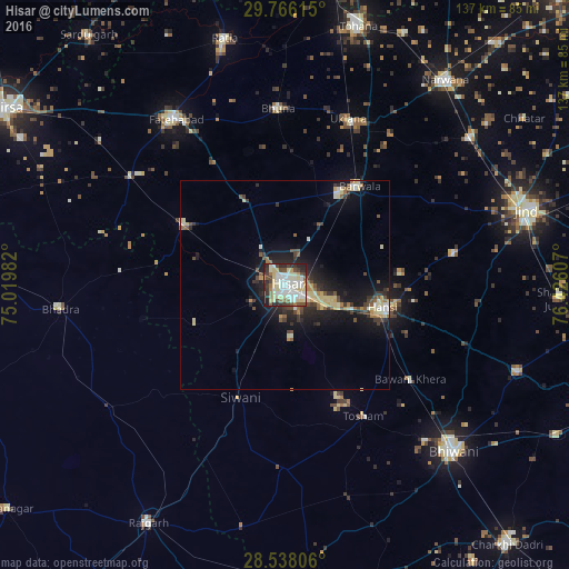
Analysis of Hisar night lights 2016
Square area 10x10 km:
 16.47%
90-99
24.8%80-89
17.46%70-79
3.37%60-69
3.37%50-59
6.55%40-49
7.74%30-39
8.13%20-29
10.32%10-19
1.79%0-9
0%Square area 50x50 km:
0.86%90-99
1.53%80-89
2.15%70-79
0.57%60-69
0.69%50-59
1.18%40-49
1.45%30-39
1.49%20-29
2.42%10-19
6.81%0-9
80.86%Clear (daylight) street map image can be seen on geolist.org.
Map coordinates:
29° 45' 58.1" North, 75° 1' 11.4" East
29° 9' 14.2" North, 75° 43' 22.6" East
28° 32' 17" North, 76° 25' 33.9" East
Some cities around Hisar sort by population:
• Gorakhpur
33 km =20.5 mi,  351°
351°
• Hānsi
24 km =14.9 mi,  103°
103°
• Fatehābād
47.8 km =29.7 mi,  327°
327°
• Bhādra
53.9 km =33.5 mi,  263°
263°
• Barwāla
29.8 km =18.5 mi,  37°
37°
• Nārnaund
41.4 km =25.7 mi,  79°
79°
• Toshām
36.8 km =22.9 mi,  149°
149°
• Uklāna
42.5 km =26.4 mi,  20°
20°
1270022 (p: 296,436)
Sources (retrieved 2019-11-25):
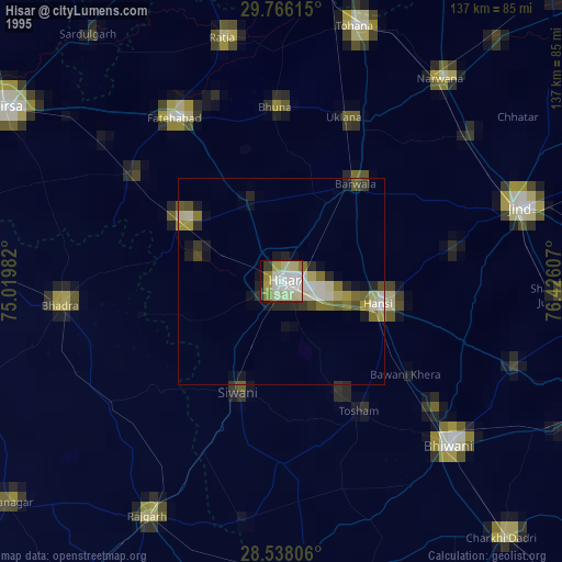
» NASA, Earths city lights 1995
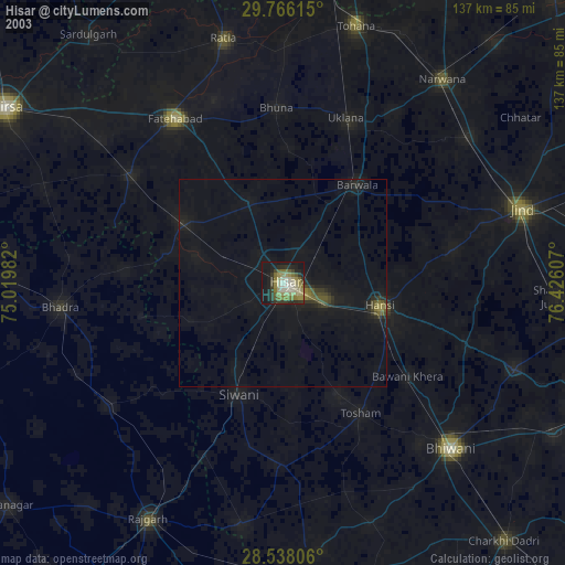
» NASA city lights 2003
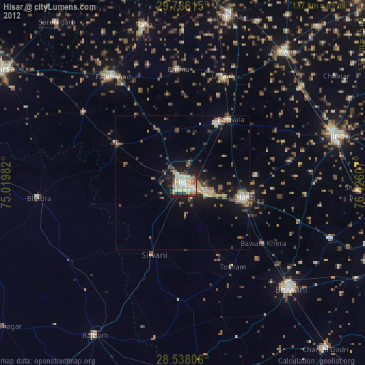
» Earth at Night: Flat Maps 2012, 2016