Nārnaund night lights from space
Night Light of Nārnaund (Haryana) from space (India) Src. Average luminocity for 10x10km area is 5.2897% and for 50x50km: 8.0664%.
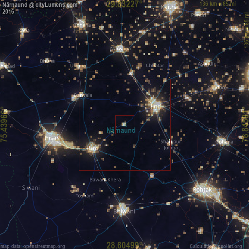
Analysis of Nārnaund night lights 2016
Square area 10x10 km:
 0.99%
0.99%90-99
0.6%80-89
0.6%70-79
1.79%60-69
0%50-59
0.6%40-49
0.2%30-39
1.59%20-29
0%10-19
0%0-9
93.65%Square area 50x50 km:
0.44%90-99
1.07%80-89
1.47%70-79
0.52%60-69
0.68%50-59
1.15%40-49
1.52%30-39
2.15%20-29
2.59%10-19
6.41%0-9
81.99%Clear (daylight) street map image can be seen on geolist.org.
Map coordinates:
29° 49' 56.2" North, 75° 26' 22.8" East
29° 13' 13.7" North, 76° 8' 34" East
28° 36' 18" North, 76° 50' 45.3" East
Some cities around Nārnaund sort by population:
• Hisar
41.4 km =25.7 mi,  259°
259°
• Jīnd
19.8 km =12.3 mi,  57°
57°
• Hānsi
21.9 km =13.6 mi,  233°
233°
• Barwāla
28 km =17.4 mi,  305°
305°
• Maham
31.6 km =19.6 mi,  152°
152°
• Bara Uchāna
27.7 km =17.2 mi,  7°
7°
• Shādīpur Julāna
27.7 km =17.2 mi,  112°
112°
• Uklāna
41.3 km =25.7 mi,  321°
321°
1261771 (p: 16,299)
Sources (retrieved 2019-11-25):
» Earth at Night: Flat Maps 2012, 2016