Hāpur night lights from space
Night Light of Hāpur (Uttar Pradesh) from space (India) Src. Average luminocity for 10x10km area is 68.1402% and for 50x50km: 43.522%.
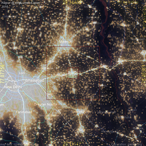
Analysis of Hāpur night lights 2016
Square area 10x10 km:
 10.04%
90-99
17.8%80-89
13.45%70-79
8.52%60-69
6.44%50-59
15.72%40-49
15.34%30-39
8.14%20-29
4.17%10-19
0.38%0-9
0%Square area 50x50 km:
2.64%90-99
6.38%80-89
7.89%70-79
5.37%60-69
7.58%50-59
8.86%40-49
10.75%30-39
9.19%20-29
12.69%10-19
21.51%0-9
7.12%Clear (daylight) street map image can be seen on geolist.org.
Map coordinates:
29° 20' 40.5" North, 77° 4' 39.2" East
28° 43' 47.5" North, 77° 46' 50.4" East
28° 6' 41.3" North, 78° 29' 1.7" East
Some cities around Hāpur sort by population:
• Pilkhua
12.3 km =7.6 mi,  261°
261°
• Gulāothi
15.7 km =9.8 mi,  175°
175°
• Dāsna
25.8 km =16 mi, 256°
• Kithor
21.7 km =13.5 mi,  45°
45°
• Saidpur
18.2 km =11.3 mi,  136°
136°
• Kharkhauda
12.4 km =7.7 mi,  342°
342°
• Farīdnagar
15.4 km =9.6 mi,  286°
286°
• Babugarh
6.5 km =4 mi,  96°
96°
1270393 (p: 242,920)
Sources (retrieved 2019-11-25):
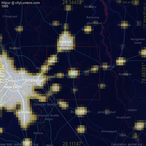
» NASA, Earths city lights 1995
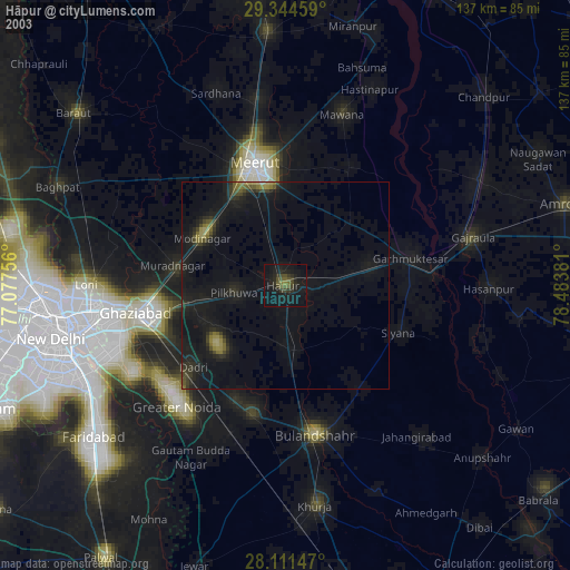
» NASA city lights 2003
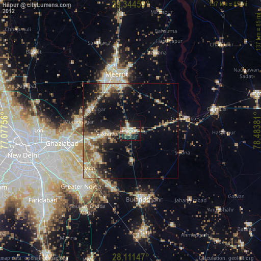
» Earth at Night: Flat Maps 2012, 2016