Gohāna night lights from space
Night Light of Gohāna (Haryana) from space (India) Src. Average luminocity for 10x10km area is 31.4563% and for 50x50km: 10.1304%.
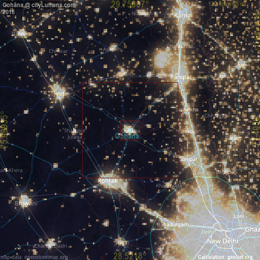
Analysis of Gohāna night lights 2016
Square area 10x10 km:
 1.79%
1.79%90-99
10.91%80-89
5.36%70-79
2.18%60-69
1.19%50-59
0.6%40-49
6.15%30-39
3.37%20-29
6.55%10-19
40.87%0-9
21.03%Square area 50x50 km:
0.35%90-99
1.09%80-89
0.98%70-79
0.56%60-69
0.89%50-59
1.41%40-49
2.7%30-39
2.49%20-29
4.39%10-19
10.37%0-9
74.76%Clear (daylight) street map image can be seen on geolist.org.
Map coordinates:
29° 45' 0.3" North, 75° 59' 57.7" East
29° 8' 16" North, 76° 42' 8.9" East
28° 31' 18.5" North, 77° 24' 20.2" East
Some cities around Gohāna sort by population:
• Rohtak
29.2 km =18.1 mi,  202°
202°
• Pānīpat
37.9 km =23.5 mi,  42°
42°
• Sonīpat
34.7 km =21.6 mi,  117°
117°
• Samālkha
32 km =19.9 mi,  70°
70°
• Safidon
30 km =18.6 mi,  354°
354°
• Kharkhauda
35.2 km =21.9 mi,  144°
144°
• Shādīpur Julāna
28.9 km =18 mi,  266°
266°
• Kheri Sāmpla
40.6 km =25.2 mi,  169°
169°
1271079 (p: 56,093)
Sources (retrieved 2019-11-25):
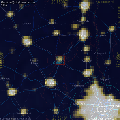
» NASA, Earths city lights 1995
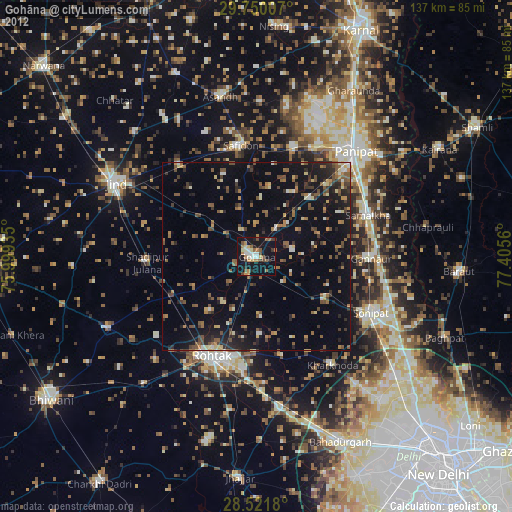
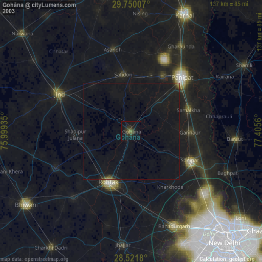
» NASA city lights 2003
» Earth at Night: Flat Maps 2012, 2016