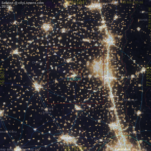
Safidon night lights from space
Night Light of Safidon (Haryana) from space (India) Src. Average luminocity for 10x10km area is 34.5057% and for 50x50km: 15.5867%.
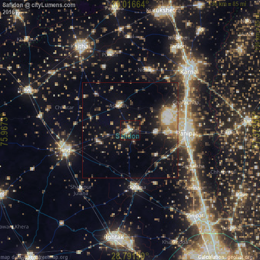
Analysis of Safidon night lights 2016
Square area 10x10 km:
 2.08%
2.08%90-99
4.55%80-89
3.41%70-79
2.46%60-69
5.87%50-59
8.33%40-49
9.85%30-39
4.55%20-29
10.61%10-19
43.75%0-9
4.55%Square area 50x50 km:
1.21%90-99
2.23%80-89
1.7%70-79
1.37%60-69
1.59%50-59
2.5%40-49
3.42%30-39
3.38%20-29
4.68%10-19
10.77%0-9
67.14%Clear (daylight) street map image can be seen on geolist.org.
Map coordinates:
30° 0' 59.9" North, 75° 58' 2.3" East
29° 24' 21.5" North, 76° 40' 13.5" East
28° 47' 29.7" North, 77° 22' 24.8" East
Some cities around Safidon sort by population:
• Pānīpat
28.9 km =18 mi,  94°
94°
• Jīnd
35.9 km =22.3 mi,  253°
253°
• Gohāna
30 km =18.6 mi,  174°
174°
• Samālkha
38.2 km =23.7 mi,  119°
119°
• Gharaunda
32.6 km =20.3 mi,  63°
63°
• Āsandh
14.3 km =8.9 mi,  333°
333°
• Pūndri
40.9 km =25.4 mi,  344°
344°
• Shādīpur Julāna
40.6 km =25.2 mi,  219°
219°
1257855 (p: 30,863)
Sources (retrieved 2019-11-25):
» Earth at Night: Flat Maps 2012, 2016