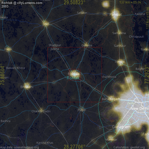
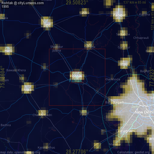
Rohtak night lights from space
Night Light of Rohtak (Haryana) from space (India) Src. Average luminocity for 10x10km area is 74.0317% and for 50x50km: 10.2875%.

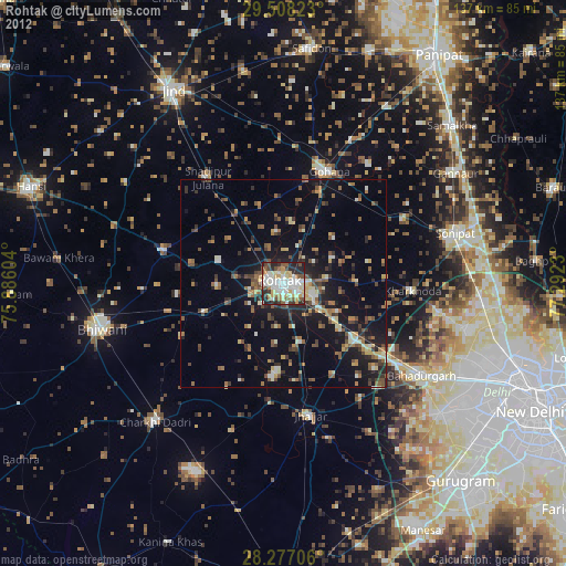
Analysis of Rohtak night lights 2016
Square area 10x10 km:
 17.06%
90-99
22.82%80-89
20.04%70-79
3.37%60-69
5.36%50-59
5.95%40-49
9.52%30-39
8.73%20-29
6.75%10-19
0.4%0-9
0%Square area 50x50 km:
0.9%90-99
1.69%80-89
1.42%70-79
0.63%60-69
1.06%50-59
1.41%40-49
2.06%30-39
2.23%20-29
3.41%10-19
7.88%0-9
77.31%Clear (daylight) street map image can be seen on geolist.org.
Map coordinates:
29° 30' 29.6" North, 75° 53' 9.7" East
28° 53' 40.1" North, 76° 35' 21" East
28° 16' 37.4" North, 77° 17' 32.3" East
Some cities around Rohtak sort by population:
• Gohāna
29.2 km =18.1 mi,  22°
22°
• Jhajjar
32.7 km =20.3 mi,  168°
168°
• Kharkhauda
31.4 km =19.5 mi,  93°
93°
• Maham
29.8 km =18.5 mi,  286°
286°
• Kalānaur
20.2 km =12.6 mi,  248°
248°
• Beri Khās
21.5 km =13.4 mi,  183°
183°
• Shādīpur Julāna
31.1 km =19.3 mi,  324°
324°
• Kheri Sāmpla
22.3 km =13.9 mi,  125°
125°
1258076 (p: 317,245)
Sources (retrieved 2019-11-25):
» NASA, Earths city lights 1995
» NASA city lights 2003
» Earth at Night: Flat Maps 2012, 2016