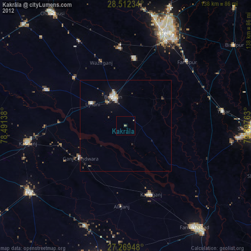
Kakrāla night lights from space
Night Light of Kakrāla (Uttar Pradesh) from space (India) Src. Average luminocity for 10x10km area is 6.697% and for 50x50km: 4.4203%.
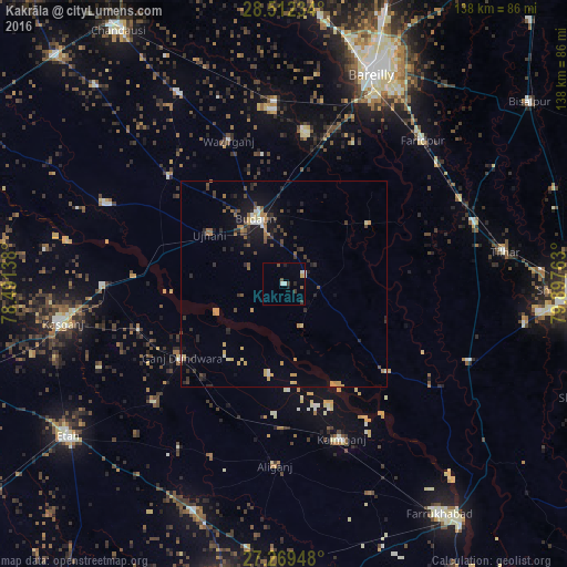
Analysis of Kakrāla night lights 2016
Square area 10x10 km:
 0.95%
0.95%90-99
1.33%80-89
0%70-79
0.76%60-69
0%50-59
1.14%40-49
1.14%30-39
2.27%20-29
0.76%10-19
1.52%0-9
90.15%Square area 50x50 km:
0.19%90-99
0.39%80-89
0.46%70-79
0.92%60-69
0.39%50-59
0.62%40-49
0.74%30-39
0.91%20-29
1.22%10-19
2.72%0-9
91.45%Clear (daylight) street map image can be seen on geolist.org.
Map coordinates:
28° 30' 44.4" North, 78° 29' 29" East
27° 53' 33.7" North, 79° 11' 40.2" East
27° 16' 10.1" North, 79° 53' 51.5" East
Some cities around Kakrāla sort by population:
• Budaun
17.5 km =10.9 mi,  337°
337°
• Ujhāni
22 km =13.7 mi,  303°
303°
• Ganj Dundwāra
30.6 km =19 mi,  234°
234°
• Dātāganj
25.6 km =15.9 mi,  54°
54°
• Sahāwar
37.1 km =23.1 mi,  253°
253°
• Usehat
11.4 km =7.1 mi,  158°
158°
• Patiāli
29.6 km =18.4 mi,  220°
220°
• Kampil
32.2 km =20 mi,  165°
165°
1268540 (p: 35,690)
Sources (retrieved 2019-11-25):
» Earth at Night: Flat Maps 2012, 2016