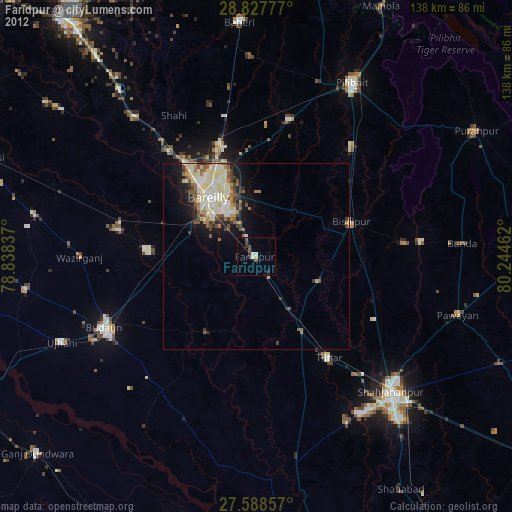
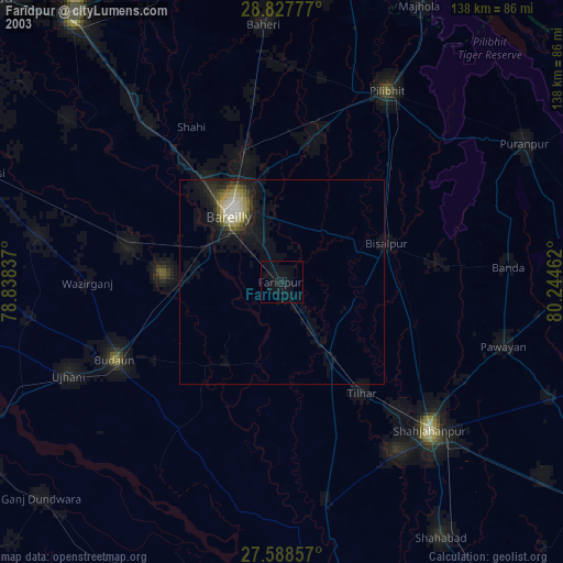
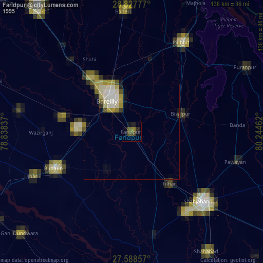
Farīdpur night lights from space
Night Light of Farīdpur (Uttar Pradesh) from space (India) Src. Average luminocity for 10x10km area is 16.6488% and for 50x50km: 12.5794%.
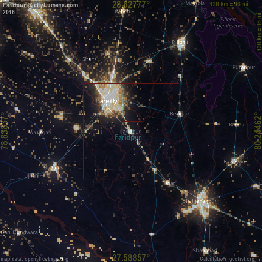
Analysis of Farīdpur night lights 2016
Square area 10x10 km:
 1.19%
1.19%90-99
2.58%80-89
2.18%70-79
2.38%60-69
0.79%50-59
1.39%40-49
3.97%30-39
2.38%20-29
4.37%10-19
6.75%0-9
72.02%Square area 50x50 km:
1.6%90-99
2.56%80-89
2.24%70-79
1.13%60-69
1.33%50-59
1.38%40-49
2.18%30-39
1.86%20-29
3.26%10-19
5.82%0-9
76.65%Clear (daylight) street map image can be seen on geolist.org.
Map coordinates:
28° 49' 40" North, 78° 50' 18.1" East
28° 12' 35.9" North, 79° 32' 29.4" East
27° 35' 18.9" North, 80° 14' 40.6" East
Some cities around Farīdpur sort by population:
• Bareilly
20.5 km =12.7 mi,  328°
328°
• Bīsalpur
27.4 km =17 mi,  70°
70°
• Tilhar
33.6 km =20.9 mi,  144°
144°
• Mīrānpur Katra
23.6 km =14.7 mi,  148°
148°
• Dātāganj
24.3 km =15.1 mi,  212°
212°
• Fatehganj West
36.6 km =22.7 mi,  321°
321°
• Khudāganj
18.4 km =11.4 mi,  112°
112°
• Barkhera Kalān
37.4 km =23.2 mi,  43°
43°
1271947 (p: 71,783)
Sources (retrieved 2019-11-25):
» NASA, Earths city lights 1995
» NASA city lights 2003
» Earth at Night: Flat Maps 2012, 2016