Bareilly night lights from space
Night Light of Bareilly (Uttar Pradesh) from space (India) Src. Average luminocity for 10x10km area is 92.8472% and for 50x50km: 20.5802%.
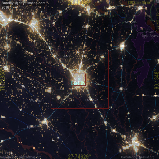
Analysis of Bareilly night lights 2016
Square area 10x10 km:
 31.15%
90-99
36.9%80-89
25.4%70-79
3.17%60-69
2.98%50-59
0%40-49
0.4%30-39
0%20-29
0%10-19
0%0-9
0%Square area 50x50 km:
2.07%90-99
3.35%80-89
2.91%70-79
1.64%60-69
2.26%50-59
2.87%40-49
4.64%30-39
4.11%20-29
6.89%10-19
12.72%0-9
56.55%Clear (daylight) street map image can be seen on geolist.org.
Map coordinates:
28° 59' 1.2" North, 78° 43' 42.8" East
28° 22' 0.4" North, 79° 25' 54" East
27° 44' 46.6" North, 80° 8' 5.3" East
Some cities around Bareilly sort by population:
• Farīdpur
20.5 km =12.7 mi,  148°
148°
• Aonla
28 km =17.4 mi,  248°
248°
• Nawābganj
27.7 km =17.2 mi,  45°
45°
• Fatehganj West
16.5 km =10.3 mi,  312°
312°
• Deoraniān
29.6 km =18.4 mi,  8°
8°
• Shāhi
23.2 km =14.4 mi,  331°
331°
• Mīrganj
29.1 km =18.1 mi, 311°
• Shergarh
32.2 km =20 mi,  348°
348°
1277013 (p: 745,435)
Sources (retrieved 2019-11-25):
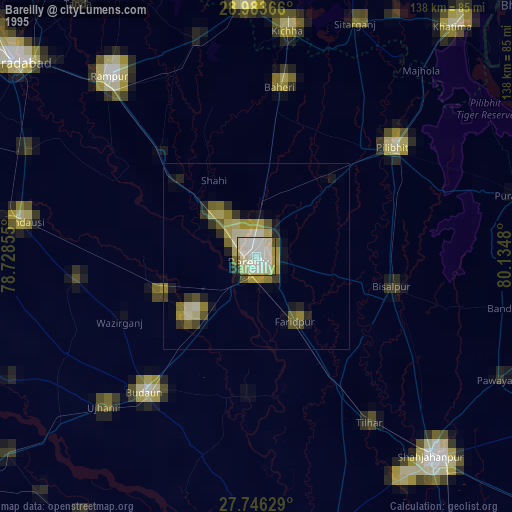
» NASA, Earths city lights 1995
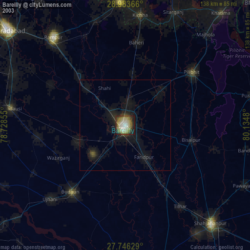
» NASA city lights 2003
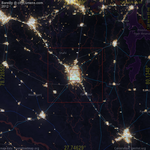
» Earth at Night: Flat Maps 2012, 2016