Elamanchili night lights from space
Night Light of Elamanchili (Andhra Pradesh) from space (India) Src. Average luminocity for 10x10km area is 17.5992% and for 50x50km: 14.5761%.
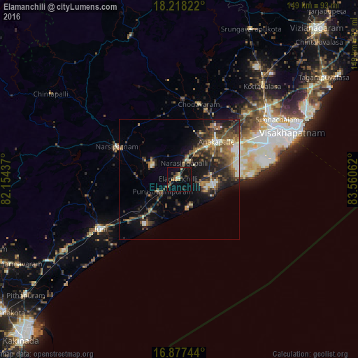
Analysis of Elamanchili night lights 2016
Square area 10x10 km:
 0.21%
0.21%90-99
1.45%80-89
1.65%70-79
2.48%60-69
2.69%50-59
2.89%40-49
4.55%30-39
3.31%20-29
2.07%10-19
12.6%0-9
66.12%Square area 50x50 km:
0.76%90-99
2.41%80-89
1.1%70-79
1.53%60-69
2.34%50-59
3.44%40-49
3.05%30-39
3.83%20-29
4.26%10-19
8.24%0-9
69.05%Clear (daylight) street map image can be seen on geolist.org.
Map coordinates:
18° 13' 5.6" North, 82° 9' 15.7" East
17° 32' 56.7" North, 82° 51' 27" East
16° 52' 38.8" North, 83° 33' 38.2" East
Some cities around Elamanchili sort by population:
• Visakhapatnam
39.3 km =24.4 mi,  68°
68°
• Gajuwaka
41.6 km =25.8 mi, 66°
• Anakāpalle
22.2 km =13.8 mi,  44°
44°
• Tuni
39.2 km =24.4 mi,  237°
237°
• Narsīpatnam
29.1 km =18.1 mi,  296°
296°
• Chodavaram
32.2 km =20 mi,  14°
14°
• Mādugula
41 km =25.5 mi,  353°
353°
• Etikoppāka
14.3 km =8.9 mi,  247°
247°
1272084 (p: 26,176)
Sources (retrieved 2019-11-25):
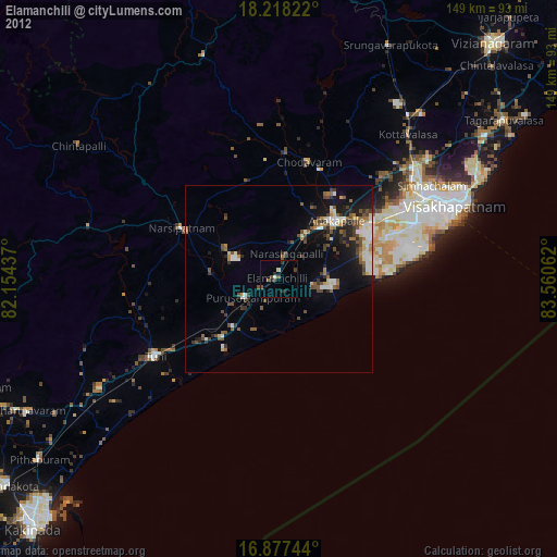
» Earth at Night: Flat Maps 2012, 2016