Chodavaram night lights from space
Night Light of Chodavaram (Andhra Pradesh) from space (India) Src. Average luminocity for 10x10km area is 10.7987% and for 50x50km: 16.2595%.
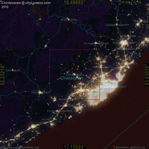
Analysis of Chodavaram night lights 2016
Square area 10x10 km:
 0%
0%90-99
0%80-89
3.46%70-79
0.87%60-69
3.46%50-59
0.87%40-49
0%30-39
2.38%20-29
3.46%10-19
1.52%0-9
83.98%Square area 50x50 km:
0.98%90-99
3.53%80-89
2.01%70-79
1.91%60-69
2.25%50-59
3.42%40-49
3.65%30-39
3.84%20-29
3.93%10-19
6.13%0-9
68.36%Clear (daylight) street map image can be seen on geolist.org.
Map coordinates:
18° 29' 48.9" North, 82° 13' 55.7" East
17° 49' 43.8" North, 82° 56' 6.9" East
17° 9' 29.7" North, 83° 38' 18.2" East
Some cities around Chodavaram sort by population:
• Visakhapatnam
32.7 km =20.3 mi,  120°
120°
• Gajuwaka
33.1 km =20.6 mi, 115°
• Anakāpalle
16.9 km =10.5 mi,  154°
154°
• Narsīpatnam
38.6 km =24 mi,  242°
242°
• Vepagunta
30.2 km =18.8 mi,  100°
100°
• Elamanchili
32.2 km =20 mi,  194°
194°
• Mādugula
15.9 km =9.9 mi,  307°
307°
• Etikoppāka
42.4 km =26.3 mi,  210°
210°
1274020 (p: 29,000)
Sources (retrieved 2019-11-25):
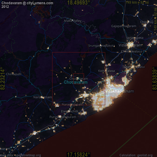
» Earth at Night: Flat Maps 2012, 2016