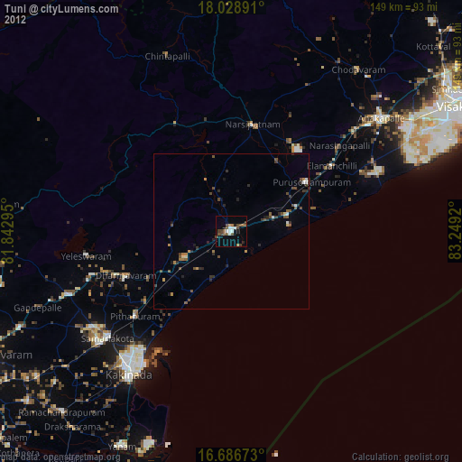
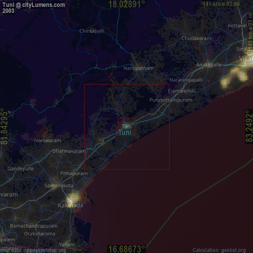
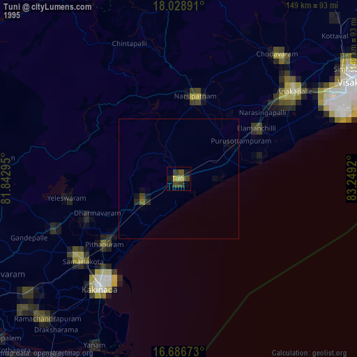
Tuni night lights from space
Night Light of Tuni (Andhra Pradesh) from space (India) Src. Average luminocity for 10x10km area is 30.0145% and for 50x50km: 5.2234%.
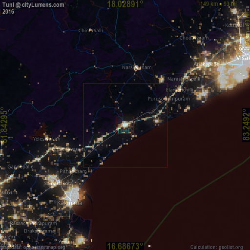
Analysis of Tuni night lights 2016
Square area 10x10 km:
 2.07%
2.07%90-99
6.2%80-89
2.89%70-79
2.89%60-69
5.37%50-59
5.79%40-49
3.51%30-39
3.1%20-29
8.47%10-19
35.54%0-9
24.17%Square area 50x50 km:
0.14%90-99
0.57%80-89
0.31%70-79
0.41%60-69
0.81%50-59
1.07%40-49
1.13%30-39
1.15%20-29
1.7%10-19
2.94%0-9
89.77%Clear (daylight) street map image can be seen on geolist.org.
Map coordinates:
18° 1' 44.1" North, 81° 50' 34.6" East
17° 21' 32.6" North, 82° 32' 45.9" East
16° 41' 12.2" North, 83° 14' 57.1" East
Some cities around Tuni sort by population:
• Kākināda
55.1 km =34.2 mi,  216°
216°
• Sāmalkot
51.7 km =32.1 mi,  229°
229°
• Pithāpuram
41.2 km =25.6 mi, 229°
• Peddāpuram
53.5 km =33.2 mi, 234°
• Narsīpatnam
35 km =21.7 mi,  11°
11°
• Elamanchili
39.2 km =24.4 mi,  57°
57°
• Etikoppāka
25.3 km =15.7 mi,  51°
51°
• vadlamuru
49.9 km =31 mi, 234°
1254054 (p: 52,658)
Sources (retrieved 2019-11-25):
» NASA, Earths city lights 1995
» NASA city lights 2003
» Earth at Night: Flat Maps 2012, 2016