Kumhāri night lights from space
Night Light of Kumhāri (Chhattisgarh) from space (India) Src. Average luminocity for 10x10km area is 70.502% and for 50x50km: 51.3126%.
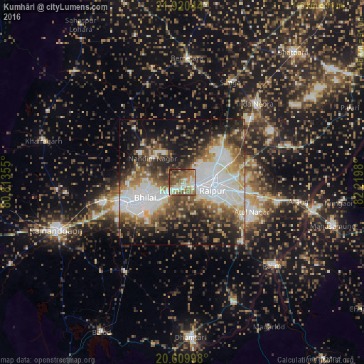
Analysis of Kumhāri night lights 2016
Square area 10x10 km:
100  12.5%
12.5%
90-99 16.27%
80-89 6.75%
70-79 9.52%
60-69 18.85%
50-59 20.04%
40-49 10.32%
30-39 3.97%
20-29 1.79%
10-19 0%
0-9 0%
12.5%90-99
16.27%80-89
6.75%70-79
9.52%60-69
18.85%50-59
20.04%40-49
10.32%30-39
3.97%20-29
1.79%10-19
0%0-9
0%Square area 50x50 km:
100 14.86%
90-99 9.24%
80-89 4.14%
70-79 4.64%
60-69 7.08%
50-59 8.36%
40-49 8.57%
30-39 7.56%
20-29 9.66%
10-19 14.58%
0-9 11.32%
14.86%90-99
9.24%80-89
4.14%70-79
4.64%60-69
7.08%50-59
8.36%40-49
8.57%30-39
7.56%20-29
9.66%10-19
14.58%0-9
11.32%Clear (daylight) street map image can be seen on geolist.org.
Map coordinates:
21° 55' 13.6" North, 80° 48' 48.8" East
21° 16' 0" North, 81° 31' 0" East
20° 36' 35.9" North, 82° 13' 11.3" East
Some cities around Kumhāri sort by population:
• Raipur
12.6 km =7.8 mi,  107°
107°
• Bhilai
11.2 km =7 mi,  235°
235°
• Durg
26.3 km =16.3 mi,  251°
251°
• Bemetāra
49.9 km =31 mi,  2°
2°
• Arang
47.5 km =29.5 mi,  99°
99°
• Simga
44.6 km =27.7 mi,  25°
25°
• Pātan
26 km =16.2 mi,  176°
176°
• Bhatgaon
23 km =14.3 mi,  124°
124°
1265660 (p: 38,334)
Sources (retrieved 2019-11-25):
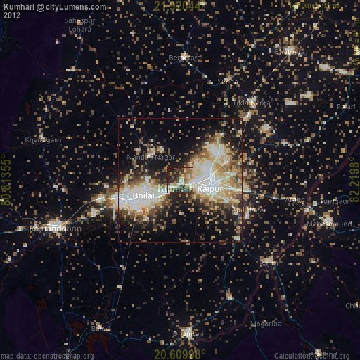
» Earth at Night: Flat Maps 2012, 2016