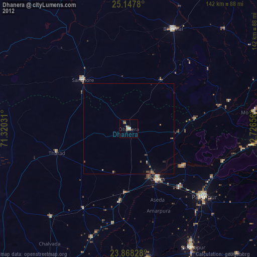
Dhanera night lights from space
Night Light of Dhanera (Gujarat) from space (India) Src. Average luminocity for 10x10km area is 9.1429% and for 50x50km: 1.1453%.
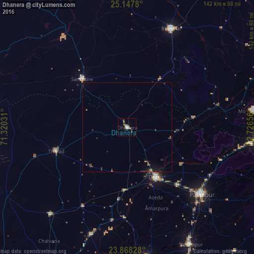
Analysis of Dhanera night lights 2016
Square area 10x10 km:
100  0%
0%
90-99 1.79%
80-89 1.39%
70-79 0.79%
60-69 1.59%
50-59 1.59%
40-49 3.17%
30-39 1.98%
20-29 0.4%
10-19 0%
0-9 87.3%
0%90-99
1.79%80-89
1.39%70-79
0.79%60-69
1.59%50-59
1.59%40-49
3.17%30-39
1.98%20-29
0.4%10-19
0%0-9
87.3%Square area 50x50 km:
100 0%
90-99 0.07%
80-89 0.11%
70-79 0.1%
60-69 0.13%
50-59 0.31%
40-49 0.28%
30-39 0.36%
20-29 0.32%
10-19 0.65%
0-9 97.67%
0%90-99
0.07%80-89
0.11%70-79
0.1%60-69
0.13%50-59
0.31%40-49
0.28%30-39
0.36%20-29
0.32%10-19
0.65%0-9
97.67%Clear (daylight) street map image can be seen on geolist.org.
Map coordinates:
25° 8' 52.1" North, 71° 19' 13.1" East
24° 30' 34.8" North, 72° 1' 24.3" East
23° 52' 5.8" North, 72° 43' 35.6" East
Some cities around Dhanera sort by population:
• Pālanpur
56.4 km =35 mi,  131°
131°
• Dīsa
32.3 km =20.1 mi,  150°
150°
• Bhīnmāl
59.9 km =37.2 mi,  24°
24°
• Un
73.8 km =45.9 mi,  200°
200°
• Sānchor
37.1 km =23.1 mi,  316°
316°
• Ābu
70.8 km =44 mi,  82°
82°
• Tharād
42.2 km =26.2 mi,  252°
252°
• Kānodar
59.9 km =37.2 mi,  141°
141°
1272962 (p: 23,656)
Sources (retrieved 2019-11-25):
» Earth at Night: Flat Maps 2012, 2016