Chittarkonda night lights from space
Night Light of Chittarkonda (Odisha) from space (India) Src. Average luminocity for 10x10km area is 2.7316% and for 50x50km: 0.5866%.
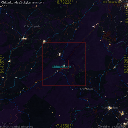
Analysis of Chittarkonda night lights 2016
Square area 10x10 km:
 0.43%
0.43%90-99
0.43%80-89
0.87%70-79
0%60-69
0%50-59
1.73%40-49
0%30-39
0%20-29
0%10-19
0%0-9
96.54%Square area 50x50 km:
0.06%90-99
0.12%80-89
0.06%70-79
0.05%60-69
0.02%50-59
0.14%40-49
0.06%30-39
0.13%20-29
0.24%10-19
0.16%0-9
98.95%Clear (daylight) street map image can be seen on geolist.org.
Map coordinates:
18° 47' 32.2" North, 81° 24' 20.8" East
18° 7' 31.2" North, 82° 6' 32" East
17° 27' 21" North, 82° 48' 43.3" East
Some cities around Chittarkonda sort by population:
• Jeypore
94.8 km =58.9 mi,  30°
30°
• Narsīpatnam
73.7 km =45.8 mi,  133°
133°
• Chodavaram
93.4 km =58 mi,  110°
110°
• Rampachodavaram
83.9 km =52.1 mi,  204°
204°
• Malakanagiri
35.4 km =22 mi,  318°
318°
• Mādugula
78.3 km =48.7 mi, 107°
• Balimila
14 km =8.7 mi,  359°
359°
• Etikoppāka
95.9 km =59.6 mi,  136°
136°
1274055 (p: 7,260)
Sources (retrieved 2019-11-25):
» Earth at Night: Flat Maps 2012, 2016