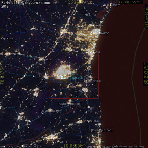
Kurinjippādi night lights from space
Night Light of Kurinjippādi (Tamil Nadu) from space (India) Src. Average luminocity for 10x10km area is 38.5671% and for 50x50km: 21.5343%.
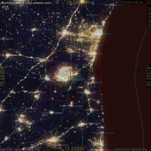
Analysis of Kurinjippādi night lights 2016
Square area 10x10 km:
 0.43%
0.43%90-99
5.84%80-89
5.19%70-79
5.63%60-69
5.84%50-59
15.58%40-49
7.58%30-39
5.84%20-29
10.61%10-19
21.65%0-9
15.8%Square area 50x50 km:
1.14%90-99
3.72%80-89
3.69%70-79
2.74%60-69
1.66%50-59
3.05%40-49
4.14%30-39
4.88%20-29
7.85%10-19
14.17%0-9
52.95%Clear (daylight) street map image can be seen on geolist.org.
Map coordinates:
12° 14' 17.9" North, 78° 53' 15.1" East
11° 33' 1" North, 79° 35' 26.4" East
10° 51' 38" North, 80° 17' 37.6" East
Some cities around Kurinjippādi sort by population:
• Vriddhāchalam
29.3 km =18.2 mi,  263°
263°
• Chidambaram
20.1 km =12.5 mi,  146°
146°
• Panruti
25.5 km =15.8 mi,  350°
350°
• Nellikkuppam
26.5 km =16.5 mi,  19°
19°
• Kīl Bhuvanagiri
13.5 km =8.4 mi, 152°
• Srīmushnam
26.3 km =16.3 mi,  230°
230°
• Annāmalainagar
22.8 km =14.2 mi,  137°
137°
• Ālappākkam
15 km =9.3 mi,  68°
68°
1265504 (p: 23,017)
Sources (retrieved 2019-11-25):
» Earth at Night: Flat Maps 2012, 2016