Changanācheri night lights from space
Night Light of Changanācheri (Kerala) from space (India) Src. Average luminocity for 10x10km area is 10.3312% and for 50x50km: 4.2432%.
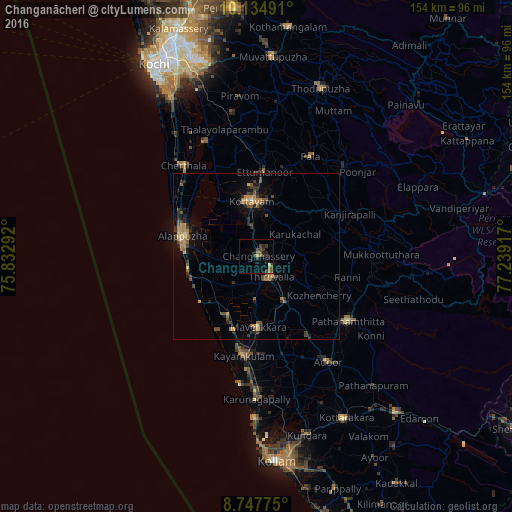
Analysis of Changanācheri night lights 2016
Square area 10x10 km:
 0%
0%90-99
0.22%80-89
1.08%70-79
0.43%60-69
0.87%50-59
3.46%40-49
3.68%30-39
4.76%20-29
4.33%10-19
1.08%0-9
80.09%Square area 50x50 km:
0.02%90-99
0.14%80-89
0.37%70-79
0.65%60-69
0.96%50-59
0.93%40-49
0.9%30-39
1.03%20-29
1.37%10-19
1.95%0-9
91.69%Clear (daylight) street map image can be seen on geolist.org.
Map coordinates:
10° 8' 5.7" North, 75° 49' 58.5" East
9° 26' 31.3" North, 76° 32' 9.7" East
8° 44' 51.9" North, 77° 14' 21" East
Some cities around Changanācheri sort by population:
• Alappuzha
23.6 km =14.7 mi,  283°
283°
• Kāyankulam
29.2 km =18.1 mi,  187°
187°
• Kottayam
16.2 km =10.1 mi,  354°
354°
• Tiruvalla
8 km =5 mi,  147°
147°
• Kalavoor
27 km =16.8 mi,  301°
301°
• Māvelikara
20.4 km =12.7 mi,  173°
173°
• Chengannūr
16.5 km =10.3 mi, 148°
• Kunnumma
16.5 km =10.3 mi,  234°
234°
1274664 (p: 51,430)
Sources (retrieved 2019-11-25):
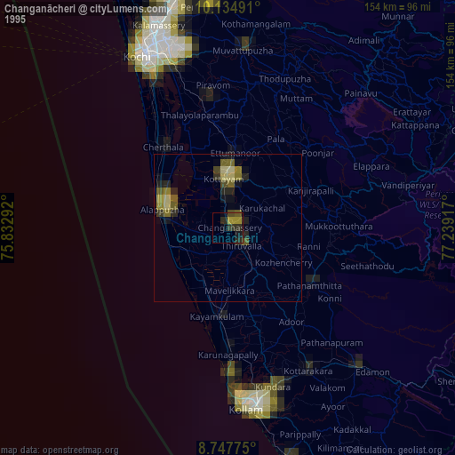
» NASA, Earths city lights 1995
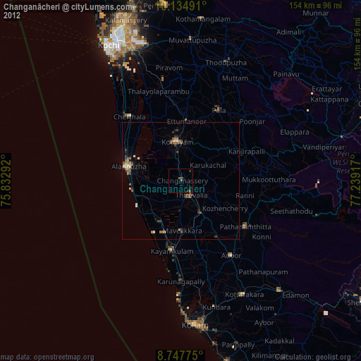
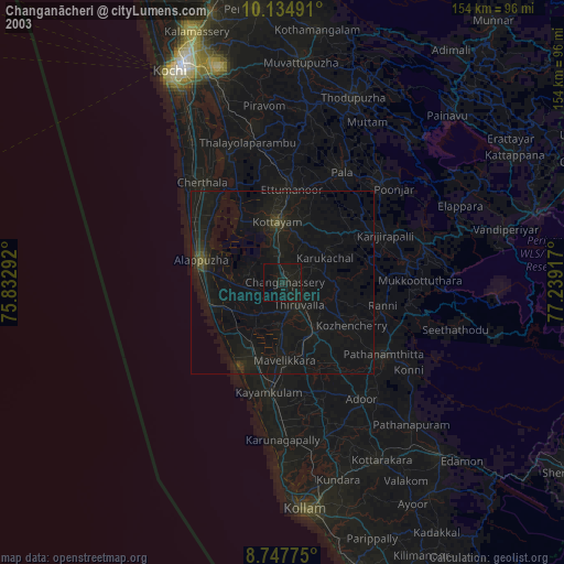
» NASA city lights 2003
» Earth at Night: Flat Maps 2012, 2016