Kāyankulam night lights from space
Night Light of Kāyankulam (Kerala) from space (India) Src. Average luminocity for 10x10km area is 12.974% and for 50x50km: 3.1127%.
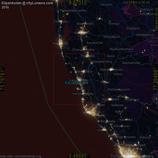
Analysis of Kāyankulam night lights 2016
Square area 10x10 km:
 0%
0%90-99
0%80-89
0%70-79
1.73%60-69
1.08%50-59
6.49%40-49
3.9%30-39
3.25%20-29
2.38%10-19
5.19%0-9
75.97%Square area 50x50 km:
0%90-99
0.12%80-89
0.14%70-79
0.29%60-69
0.48%50-59
0.87%40-49
0.84%30-39
0.99%20-29
1.11%10-19
0.95%0-9
94.2%Clear (daylight) street map image can be seen on geolist.org.
Map coordinates:
9° 52' 30.5" North, 75° 47' 52.1" East
9° 10' 54.2" North, 76° 30' 3.3" East
8° 29' 13" North, 77° 12' 14.6" East
Some cities around Kāyankulam sort by population:
• Tiruvalla
23.7 km =14.7 mi,  20°
20°
• Changanācheri
29.2 km =18.1 mi,  7°
7°
• Adūr
25.5 km =15.8 mi,  96°
96°
• Ponmana
19.4 km =12.1 mi,  173°
173°
• Māvelikara
10.6 km =6.6 mi,  35°
35°
• Chengannūr
19.5 km =12.1 mi, 40°
• Kattanam
6.9 km =4.3 mi, 95°
• Kunnumma
21.7 km =13.5 mi,  333°
333°
1267360 (p: 64,183)
Sources (retrieved 2019-11-25):
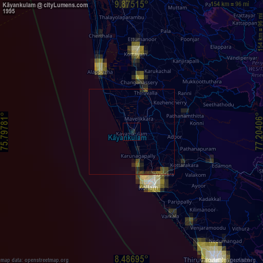
» NASA, Earths city lights 1995
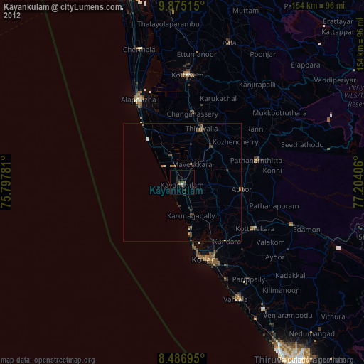
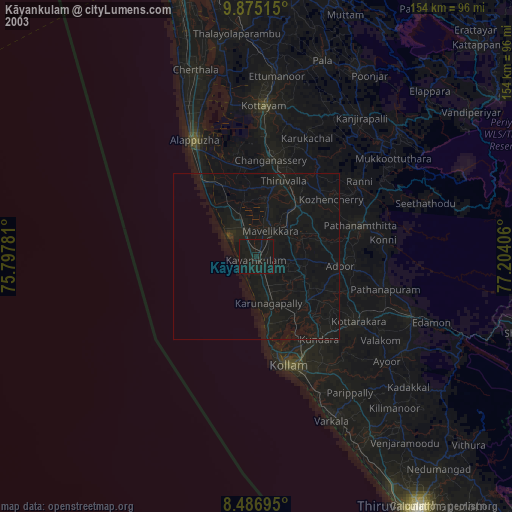
» NASA city lights 2003
» Earth at Night: Flat Maps 2012, 2016