Tiruvalla night lights from space
Night Light of Tiruvalla (Kerala) from space (India) Src. Average luminocity for 10x10km area is 11.79% and for 50x50km: 3.7381%.
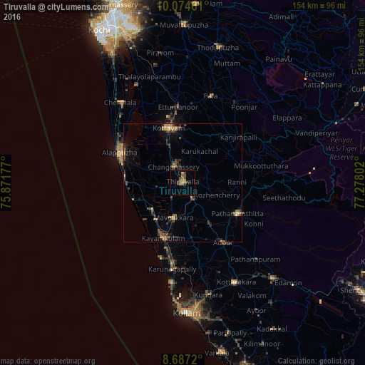
Analysis of Tiruvalla night lights 2016
Square area 10x10 km:
 0%
0%90-99
0.22%80-89
0.65%70-79
1.08%60-69
4.11%50-59
3.9%40-49
3.46%30-39
2.38%20-29
1.52%10-19
0.43%0-9
82.25%Square area 50x50 km:
0%90-99
0.14%80-89
0.25%70-79
0.48%60-69
0.81%50-59
1.01%40-49
0.86%30-39
0.93%20-29
1.16%10-19
1.47%0-9
92.88%Clear (daylight) street map image can be seen on geolist.org.
Map coordinates:
10° 4' 28.6" North, 75° 52' 18.4" East
9° 22' 53.8" North, 76° 34' 29.6" East
8° 41' 13.9" North, 77° 16' 40.9" East
Some cities around Tiruvalla sort by population:
• Kāyankulam
23.7 km =14.7 mi,  200°
200°
• Kottayam
23.6 km =14.7 mi,  345°
345°
• Changanācheri
8 km =5 mi,  327°
327°
• Pathanāmthitta
26.2 km =16.3 mi,  119°
119°
• Māvelikara
13.7 km =8.5 mi,  188°
188°
• Chengannūr
8.5 km =5.3 mi,  148°
148°
• Kattanam
22.9 km =14.2 mi,  183°
183°
• Kunnumma
17.9 km =11.1 mi,  261°
261°
1254335 (p: 57,223)
Sources (retrieved 2019-11-25):
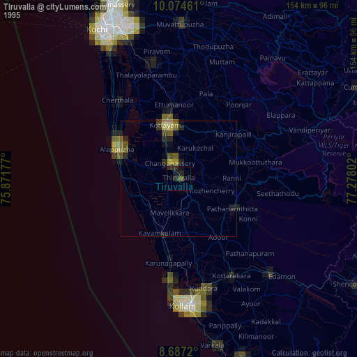
» NASA, Earths city lights 1995
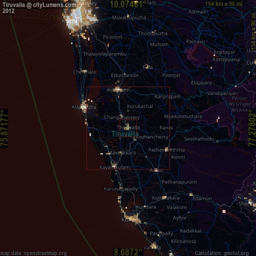
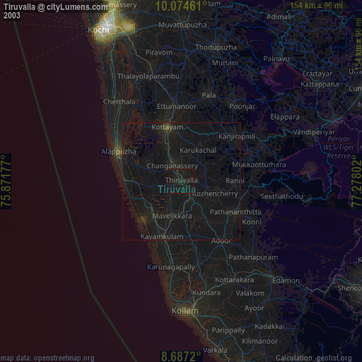
» NASA city lights 2003
» Earth at Night: Flat Maps 2012, 2016