Panna night lights from space
Night Light of Panna (Madhya Pradesh) from space (India) Src. Average luminocity for 10x10km area is 29.754% and for 50x50km: 4.7435%.
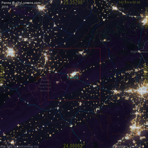
Analysis of Panna night lights 2016
Square area 10x10 km:
 4.37%
4.37%90-99
7.74%80-89
2.78%70-79
0.6%60-69
3.57%50-59
3.77%40-49
3.77%30-39
1.98%20-29
6.15%10-19
38.69%0-9
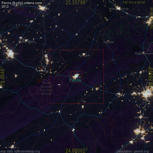
26.59%Square area 50x50 km:
0.33%90-99
0.58%80-89
0.31%70-79
0.29%60-69
0.52%50-59
0.96%40-49
1.09%30-39
0.97%20-29
1.22%10-19
3.1%0-9
90.62%Clear (daylight) street map image can be seen on geolist.org.
Map coordinates:
25° 21' 28.7" North, 79° 29' 4.6" East
24° 43' 15.4" North, 80° 11' 15.8" East
24° 4' 50.2" North, 80° 53' 27.1" East
Some cities around Panna sort by population:
• Khajuraho Group of Monuments
29.3 km =18.2 mi,  298°
298°
• Nāgod
43.8 km =27.2 mi,  112°
112°
• Naraini
59.7 km =37.1 mi,  29°
29°
• Ajaigarh
21.1 km =13.1 mi,  20°
20°
• Rājnagar
33.6 km =20.9 mi, 303°
• Amānganj
36.1 km =22.4 mi,  205°
205°
• Pawai
50.6 km =31.4 mi,  182°
182°
• Chandla
39 km =24.2 mi,  0°
0°
1260454 (p: 46,791)
Sources (retrieved 2019-11-25):
» Earth at Night: Flat Maps 2012, 2016