Ajaigarh night lights from space
Night Light of Ajaigarh (Madhya Pradesh) from space (India) Src. Average luminocity for 10x10km area is 12.0208% and for 50x50km: 3.185%.
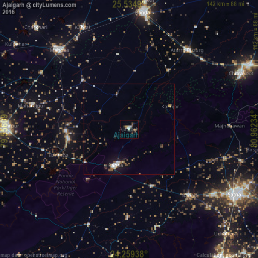
Analysis of Ajaigarh night lights 2016
Square area 10x10 km:
 1.52%
1.52%90-99
2.27%80-89
1.52%70-79
0.76%60-69
0%50-59
2.84%40-49
3.03%30-39
1.52%20-29
1.14%10-19
2.46%0-9
82.95%Square area 50x50 km:
0.28%90-99
0.49%80-89
0.22%70-79
0.16%60-69
0.43%50-59
0.64%40-49
0.68%30-39
0.37%20-29
0.97%10-19
2.05%0-9
93.7%Clear (daylight) street map image can be seen on geolist.org.
Map coordinates:
25° 32' 5.6" North, 79° 33' 21.9" East
24° 53' 55.6" North, 80° 15' 33.2" East
24° 15' 33.8" North, 80° 57' 44.4" East
Some cities around Ajaigarh sort by population:
• Panna
21.1 km =13.1 mi,  200°
200°
• Atarra
53.3 km =33.1 mi,  36°
36°
• Khajuraho Group of Monuments
33.3 km =20.7 mi,  260°
260°
• Nāgod
49.5 km =30.8 mi,  137°
137°
• Naraini
39 km =24.2 mi,  33°
33°
• Rājnagar
35.1 km =21.8 mi,  268°
268°
• Chandla
20.3 km =12.6 mi,  340°
340°
• Kothi
54.8 km =34.1 mi,  107°
107°
1279181 (p: 14,640)
Sources (retrieved 2019-11-25):
» Earth at Night: Flat Maps 2012, 2016