Būndi night lights from space
Night Light of Būndi (Rajasthan) from space (India) Src. Average luminocity for 10x10km area is 57.1151% and for 50x50km: 11.9346%.
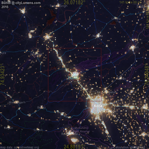

Analysis of Būndi night lights 2016
Square area 10x10 km:
 8.93%
8.93%90-99
16.67%80-89
10.32%70-79
6.94%60-69
3.37%50-59
6.55%40-49
5.95%30-39
9.13%20-29
24.4%10-19
7.74%0-9
0%Square area 50x50 km:
0.8%90-99
2.29%80-89
1.41%70-79
1.32%60-69
0.99%50-59
1.5%40-49
2.45%30-39
2.49%20-29
3.92%10-19
10.84%0-9
71.98%Clear (daylight) street map image can be seen on geolist.org.
Map coordinates:
26° 4' 18.6" North, 74° 56' 3.2" East
25° 26' 18.8" North, 75° 38' 14.5" East
24° 48' 6.9" North, 76° 20' 25.7" East
Some cities around Būndi sort by population:
• Kota
34.9 km =21.7 mi,  144°
144°
• Rāwatbhāta
56.7 km =35.2 mi,  184°
184°
• Lākheri
60 km =37.3 mi,  64°
64°
• Keshorai Pātan
34.4 km =21.4 mi,  118°
118°
• Deoli
43.8 km =27.2 mi,  323°
323°
• Jahāzpur
41.5 km =25.8 mi,  299°
299°
• Kāpren
44 km =27.3 mi,  94°
94°
• Nainwa
42.7 km =26.5 mi,  29°
29°
1275103 (p: 98,569)
Sources (retrieved 2019-11-25):
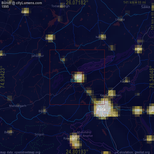
» NASA, Earths city lights 1995
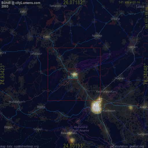
» NASA city lights 2003
» Earth at Night: Flat Maps 2012, 2016