Jahāzpur night lights from space
Night Light of Jahāzpur (Rajasthan) from space (India) Src. Average luminocity for 10x10km area is 16.483% and for 50x50km: 6.8046%.
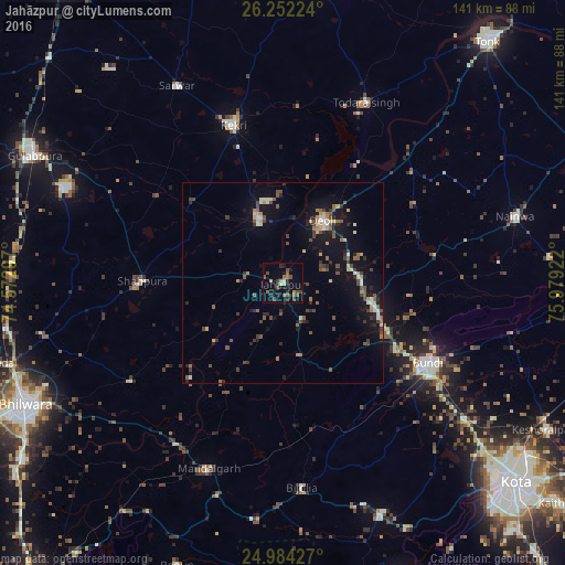
Analysis of Jahāzpur night lights 2016
Square area 10x10 km:
 0%
0%90-99
0.95%80-89
1.33%70-79
1.52%60-69
3.22%50-59
3.79%40-49
6.44%30-39
3.22%20-29
6.06%10-19
3.6%0-9
69.89%Square area 50x50 km:
0.19%90-99
0.93%80-89
0.52%70-79
0.76%60-69
0.86%50-59
1.23%40-49
1.75%30-39
1.1%20-29
1.55%10-19
5.2%0-9
85.9%Clear (daylight) street map image can be seen on geolist.org.
Map coordinates:
26° 15' 8.1" North, 74° 34' 22.7" East
25° 37' 11.8" North, 75° 16' 33.9" East
24° 59' 3.4" North, 75° 58' 45.2" East
Some cities around Jahāzpur sort by population:
• Būndi
41.5 km =25.8 mi,  119°
119°
• Kekri
41.1 km =25.5 mi,  342°
342°
• Shāhpura
35.2 km =21.9 mi,  270°
270°
• Todaraisingh
49.4 km =30.7 mi,  24°
24°
• Māndalgarh
51.6 km =32.1 mi,  203°
203°
• Deoli
18.5 km =11.5 mi,  34°
34°
• Sarwār
55.9 km =34.7 mi,  331°
331°
• Uniāra
59.6 km =37 mi,  354°
354°
1269545 (p: 20,350)
Sources (retrieved 2019-11-25):
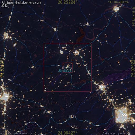
» Earth at Night: Flat Maps 2012, 2016