Buguda night lights from space
Night Light of Buguda (Odisha) from space (India) Src. Average luminocity for 10x10km area is 6.6942% and for 50x50km: 5.0183%.
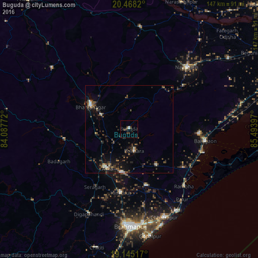
Analysis of Buguda night lights 2016
Square area 10x10 km:
 1.03%
1.03%90-99
0.62%80-89
0%70-79
0%60-69
0.62%50-59
1.03%40-49
2.48%30-39
2.48%20-29
1.45%10-19
3.51%0-9
86.78%Square area 50x50 km:
0.32%90-99
0.58%80-89
0.24%70-79
0.24%60-69
0.36%50-59
1.28%40-49
1.44%30-39
1.25%20-29
1.71%10-19
3.44%0-9
89.13%Clear (daylight) street map image can be seen on geolist.org.
Map coordinates:
20° 28' 5.5" North, 84° 5' 15.8" East
19° 48' 29" North, 84° 47' 27" East
19° 8' 42.6" North, 85° 29' 38.3" East
Some cities around Buguda sort by population:
• Hinjilikatu
36.6 km =22.7 mi,  187°
187°
• Āsika
25.8 km =16 mi,  212°
212°
• Bhanjanagar
25.5 km =15.8 mi,  301°
301°
• Polasara
12.9 km =8 mi,  169°
169°
• Purushottampur
33.5 km =20.8 mi,  162°
162°
• Kodala
25.8 km =16 mi,  142°
142°
• Khallikot
38 km =23.6 mi,  125°
125°
• Belaguntha
18 km =11.2 mi, 297°
1275132 (p: 14,297)
Sources (retrieved 2019-11-25):
» Earth at Night: Flat Maps 2012, 2016