Belaguntha night lights from space
Night Light of Belaguntha (Odisha) from space (India) Src. Average luminocity for 10x10km area is 10.4632% and for 50x50km: 2.8944%.
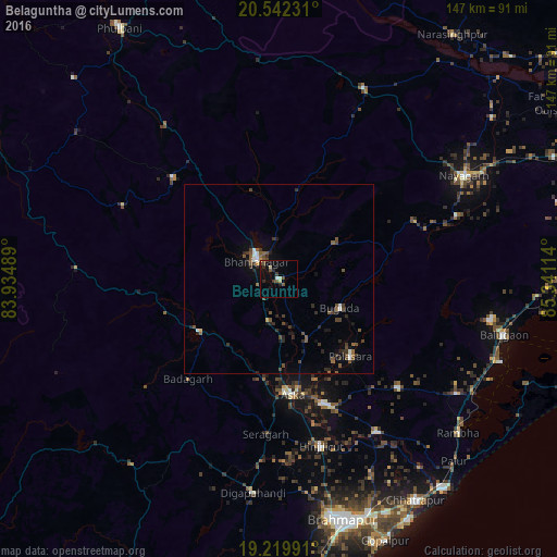
Analysis of Belaguntha night lights 2016
Square area 10x10 km:
 0.43%
0.43%90-99
0.65%80-89
2.38%70-79
0.22%60-69
0%50-59
2.6%40-49
2.6%30-39
2.16%20-29
3.25%10-19
6.49%0-9
79.22%Square area 50x50 km:
0.21%90-99
0.25%80-89
0.12%70-79
0.1%60-69
0.11%50-59
0.88%40-49
0.89%30-39
0.75%20-29
0.9%10-19
1.34%0-9
94.43%Clear (daylight) street map image can be seen on geolist.org.
Map coordinates:
20° 32' 32.3" North, 83° 56' 5.6" East
19° 52' 57" North, 84° 38' 16.8" East
19° 13' 11.7" North, 85° 20' 28.1" East
Some cities around Belaguntha sort by population:
• Hinjilikatu
46 km =28.6 mi,  165°
165°
• Āsika
30.3 km =18.8 mi,  175°
175°
• Bhanjanagar
7.7 km =4.8 mi,  310°
310°
• Polasara
27.9 km =17.3 mi,  138°
138°
• Sorada
25.6 km =15.9 mi,  238°
238°
• Buguda
18 km =11.2 mi,  117°
117°
• Kodala
42.8 km =26.6 mi,  132°
132°
• Udayagiri
38.9 km =24.2 mi, 313°
1276568 (p: 10,360)
Sources (retrieved 2019-11-25):
» Earth at Night: Flat Maps 2012, 2016