Kodala night lights from space
Night Light of Kodala (Odisha) from space (India) Src. Average luminocity for 10x10km area is 7.5455% and for 50x50km: 6.6582%.
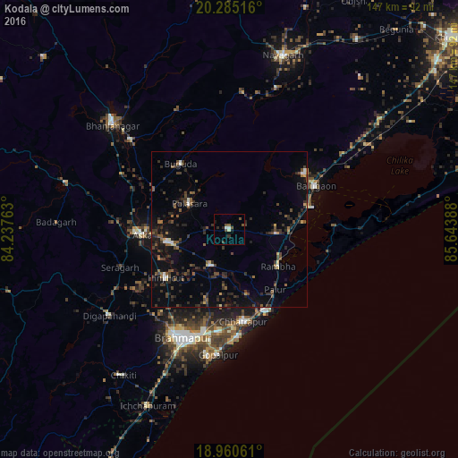
Analysis of Kodala night lights 2016
Square area 10x10 km:
 0.83%
0.83%90-99
1.03%80-89
0.62%70-79
0%60-69
0%50-59
2.07%40-49
2.89%30-39
1.86%20-29
1.45%10-19
1.65%0-9
87.6%Square area 50x50 km:
0.28%90-99
0.54%80-89
0.33%70-79
0.34%60-69
0.47%50-59
1.42%40-49
1.69%30-39
2.15%20-29
2.78%10-19
3.8%0-9
86.2%Clear (daylight) street map image can be seen on geolist.org.
Map coordinates:
20° 17' 6.6" North, 84° 14' 15.5" East
19° 37' 27.3" North, 84° 56' 26.7" East
18° 57' 38.2" North, 85° 38' 38" East
Some cities around Kodala sort by population:
• Hinjilikatu
25.9 km =16.1 mi,  232°
232°
• Āsika
29.4 km =18.3 mi,  267°
267°
• Polasara
15.4 km =9.6 mi,  300°
300°
• Purushottampur
12.9 km =8 mi,  206°
206°
• Buguda
25.8 km =16 mi,  322°
322°
• Khallikot
15.3 km =9.5 mi,  96°
96°
• Ganjām
28.8 km =17.9 mi,  156°
156°
• Rambha
20.5 km =12.7 mi,  125°
125°
1266422 (p: 13,187)
Sources (retrieved 2019-11-25):
» Earth at Night: Flat Maps 2012, 2016