Dindori night lights from space
Night Light of Dindori (Madhya Pradesh) from space (India) Src. Average luminocity for 10x10km area is 15.4603% and for 50x50km: 1.3171%.
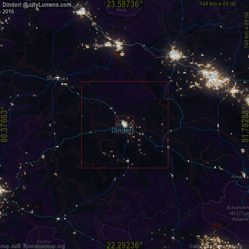
Analysis of Dindori night lights 2016
Square area 10x10 km:
 1.59%
1.59%90-99
3.17%80-89
0%70-79
0.79%60-69
1.39%50-59
4.76%40-49
2.58%30-39
3.77%20-29
0.79%10-19
4.56%0-9
76.59%Square area 50x50 km:
0.06%90-99
0.16%80-89
0%70-79
0.1%60-69
0.1%50-59
0.38%40-49
0.35%30-39
0.51%20-29
0.36%10-19
0.47%0-9
97.51%Clear (daylight) street map image can be seen on geolist.org.
Map coordinates:
23° 35' 14.5" North, 80° 22' 35.9" East
22° 56' 29.1" North, 81° 4' 47.1" East
22° 17' 32.5" North, 81° 46' 58.4" East
Some cities around Dindori sort by population:
• Shahdol
48.6 km =30.2 mi,  36°
36°
• Umaria
69.4 km =43.1 mi,  339°
339°
• Pāli
47.2 km =29.3 mi,  355°
355°
• Burhar
55.4 km =34.4 mi,  56°
56°
• Anūppur
65.1 km =40.5 mi,  73°
73°
• Bodri
43.8 km =27.2 mi, 55°
• Shāhpur
12.1 km =7.5 mi,  319°
319°
• Amarkantak
75.7 km =47 mi,  113°
113°
1272540 (p: 19,263)
Sources (retrieved 2019-11-25):
» Earth at Night: Flat Maps 2012, 2016