Bhadohi night lights from space
Night Light of Bhadohi (Uttar Pradesh) from space (India) Src. Average luminocity for 10x10km area is 71.871% and for 50x50km: 30.4375%.
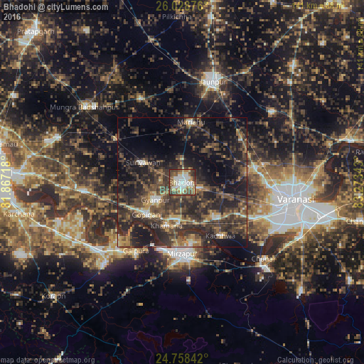
Analysis of Bhadohi night lights 2016
Square area 10x10 km:
 15.48%
90-99
20.04%80-89
8.93%70-79
7.74%60-69
10.71%50-59
12.1%40-49
14.68%30-39
8.73%20-29
1.59%10-19
0%0-9
0%Square area 50x50 km:
1.53%90-99
2.53%80-89
1.95%70-79
3.4%60-69
4.37%50-59
6.21%40-49
9.98%30-39
12.09%20-29
16.11%10-19
18.11%0-9
23.74%Clear (daylight) street map image can be seen on geolist.org.
Map coordinates:
26° 1' 43.5" North, 81° 52' 1.8" East
25° 23' 42.9" North, 82° 34' 13.1" East
24° 45' 30.3" North, 83° 16' 24.3" East
Some cities around Bhadohi sort by population:
• Mirzāpur
27.8 km =17.3 mi,  181°
181°
• Machhlīshahr
36 km =22.4 mi,  333°
333°
• Mariāhu
23.5 km =14.6 mi,  8°
8°
• Suriānwān
17 km =10.6 mi,  296°
296°
• Kachhwa
25.5 km =15.8 mi,  145°
145°
• Gyānpur
12.5 km =7.8 mi,  236°
236°
• Barāgaon
25.1 km =15.6 mi,  81°
81°
• Zafarābād
37.5 km =23.3 mi,  25°
25°
1276335 (p: 78,568)
Sources (retrieved 2019-11-25):
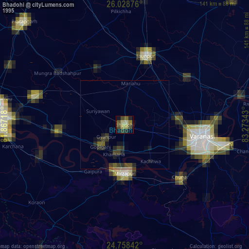
» NASA, Earths city lights 1995
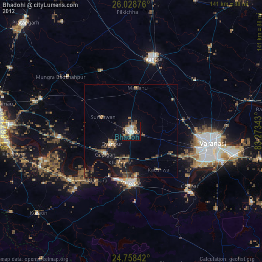
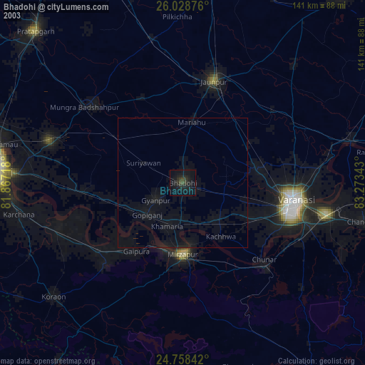
» NASA city lights 2003
» Earth at Night: Flat Maps 2012, 2016